OpenStreetMap

ika-chan!'s Diary

Recent diary entries

No more daily changesets

Posted by ika-chan! on 1 March 2024 in English. Last updated on 6 March 2024.

I decided to end my 2,687-day non-stop editing streak today (1st March 2024), because my mental and physical health has declined to a point where I need to rest more.

A changeset or more per day from Day 1 may have been a good challenge back in October 2016, but maintaining a high-stakes daily editing streak has become too much for me to handle.

I don’t know how long this break will last: it depends on what I need to catch up on other things.

The first paragraph was corrected from 2,686 days to 2,687 days, to reflect the final tally on the How did you contribute to OpenStreetMap? service by Pascal Neis.
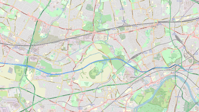
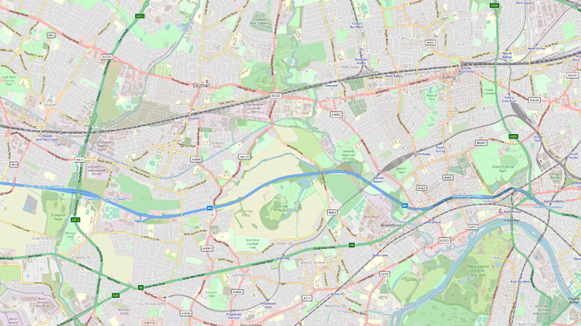
Location: 75008, Ile-de-France, Metropolitan France, 75008, France

The Greek OSM community would like to hear from you on how junction:ref=* can be used on free-flowing motorway interchanges.

Examples of motorway interchanges under discussion include the M4/M25 interchange near Heathrow, and the Α1/Α6 interchange near Metamorfosi.

Whatever is decided by the Greek community may influence how we use junction:ref=* for similar interchanges worldwide.

Comments and suggestions may be posted on the key’s talk page, or the forum thread: both pages are monitored.

Location: Μποφίλια, Metamorfosi, Municipality of Metamorfosi, Regional Unit of North Athens, Attica, 144 52, Greece

Thoughts about setting up an OSM server

Posted by ika-chan! on 21 December 2018 in English.

I wished that setting up a standalone OpenStreetMap server, with the likes of Rails, Mapnik and Nominatim all in one computer, was as easy as setting up MediaWiki. I think that the ease of setting up MediaWiki is why MediaWiki-based wikis are so popular.

If setting up a standalone OpenStreetMap server was as easy as setting up MediaWiki, many people would be mapping their own worlds on their own servers, saving OpenStreetMap the headache of dealing with fictional edits.

Long story short, I still wish to set up a standalone OpenStreetMap server for my NationStates nation under Ubuntu 18.04 LTS, but I think I will need help with the development of a simple method to set-up such a server — not only due to my poor health, but also to make things a lot easier for other fictional mappers that can’t fit their worlds into OpenGeoFiction.

I am sorry about the request for help with the server setup instructions, but my health matters more. At least I got my feelings about the complexity of setting up such a server out of the way before it overwhelms me.

Crimea dispute

Posted by ika-chan! on 2 December 2018 in English.

I have not really been following the OSM dispute over the borders of Crimea for health reasons, but I think that the problem lies with how we portray disputed borders and how we are not really providing the appropriate tag schemes to make it easy for data users to portray borders as they see fit.

I do not know if anyone is considering proposing the appropriate tag schemes that make it easy for data users to portray borders as they see fit, instead of arguing over the “on the ground” rule and whether Crimea belongs to Ukraine, Russia or the Isle of Wight (hint: they are both diamond shaped).

As for OSM-carto, the stylesheet should be truly neutral, showing all disputed borders as a dotted line version of the relevant administrative level.

There is a real danger of the project falling apart if we keep limiting ourselves to choosing one side over another. There are people like me who just want to make maps, instead of arguing over politics, and in my case, putting my already fragile mental health in danger.

Meanwhile, how do we get Nominatim to recognise Bir Tawil (3335661) as not part of any country?

Today I created a draft tutorial on how to modify the standard OpenStreetMap Carto stylesheet to use road colours that commonly appear on maps in the Republic of Ireland and the United Kingdom. This simple tutorial is available with two shield styles, as shown below:

Simple colour change

Colour change with British shields

It looks like the tutorial will only require five simple steps: therefore, there is no need to create a separate GitHub fork.

The new colours are not direct copies from the pre-2015 versions of the Standard tile layer, because the old road colours would have appeared too dark and too dull.

Location: Strand-on-the-Green, Grove Park, London Borough of Hounslow, London, Greater London, England, W4 3RL, United Kingdom

Potential border issue: Catalonia

Posted by ika-chan! on 27 October 2017 in English.

Source: http://www.bbc.co.uk/news/world-europe-41780116

The Catalan regional parliament has voted to declare independence from Spain, in a vote that was boycotted by opposition MPs. Spain currently disputes the independence bid, and the EU considers it a domestic issue not worth butting into … yet.

I have thus identified a potential border issue in OpenStreetMap that should be resolved before it gets out of hand.

How should we approach this?

AAARGH !!! Those Spammers !

Posted by ika-chan! on 17 May 2017 in English. Last updated on 18 May 2017.

Can someone please do something about the spammers? I am a regular reader of the OpenStreetMap Blog feed, but recently they have been overrun by spammers that abuse the user diary system and go as far as to peddle software cracking (warez).

Extra: Another thing I noticed is that the OpenStreetMap signup page does not have that “I’m not a robot” captcha, which is a far cry from the days you had to figure out nearly-indecipherable words. If there was one, it would significantly reduce automated spammers.

Extra II: But the captcha I refer to helps Google Street View, even though it will be some time before OSM can excel in the street view sector. So what now? Panic?

In a bid to speed development of self-driving cars, Geely has called on the Chinese Government to relax strict laws on mapping (Reuters, 2 March 2017).

This is relevant to OpenStreetMap, because the Surveying and Mapping Law bans all private surveying and mapping activities in mainland China.

The law means that OpenStreetMap is illegal in mainland China, and there have been cases where casual mappers have been prosecuted (see WikiProject China on OpenStreetMap Wiki).

Location: 东厂社区, Dongcheng District, Beijing, 100010, China