Loading...
Way: Raton Subdivision (247154514)
Version #1
SE Colorado alignments etc along hwy 350
Tags
| electrified | no |
|---|---|
| gauge | 1435 |
| name | Raton Subdivision |
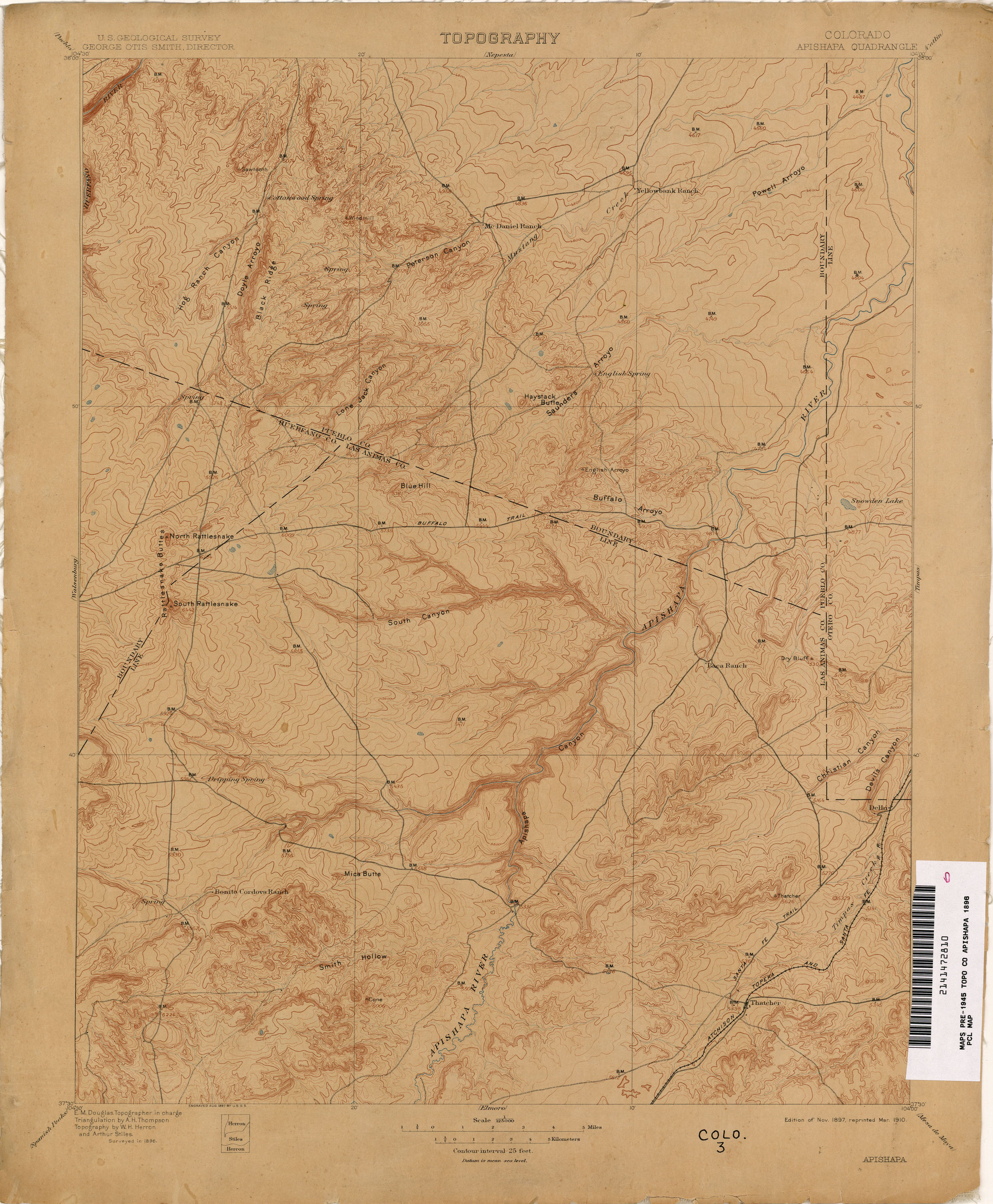
| note | old alignment on http://www.lib.utexas.edu/maps/topo/colorado/pclmaps-topo-co-apishapa-1896.jpg |
| old_railway_operator | AT&SF |
| operator | BNSF |
| railway | rail |
| tiger:cfcc | B11 |
| tiger:county | Otero, CO |
| tiger:name_base | Burlington Northern Santa Fe R |
Nodes
20 nodes
- 2540893934 (part of way Raton Subdivision (247154521))
- 2540893924
- 2540893974
- 2540893942
- 2540893977
- 177743925
- 2540893962
- 2540893988
- 2540893998
- 177743926
- 2540893908
- 2540893967
- 177747311 (part of way State Highway 71 (17115379))
- 2540893978
- 2540893976 (part of way Raton Subdivision (599436631))
- 177743928 (part of way Raton Subdivision (599436631))
- 177743929 (part of ways 17114305 and Raton Subdivision (599436633))
- 2540893970 (part of way Raton Subdivision (599436633))
- 2540893947 (part of way Raton Subdivision (599436633))
- 2540893973 (part of ways Raton Subdivision (247154508) and Raton Subdivision (599436633))
Welcome to OpenStreetMap!
OpenStreetMap is a map of the world, created by people like you and free to use under an open license.
Hosting is supported by Fastly, OSMF corporate members, and other partners.
| https://openstreetmap.org/copyright | https://openstreetmap.org |
| Copyright OpenStreetMap and contributors, under an open license | |