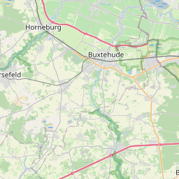
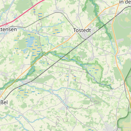
Relation: Buxtehude (279078)
Version #31
fixed postcode boundaries in Buxtehude
Tags
| TMC:cid_58:tabcd_1:Class | Area |
|---|---|
| TMC:cid_58:tabcd_1:LCLversion | 9.00 |
| TMC:cid_58:tabcd_1:LocationCode | 3250 |
| admin_centre:postal_code | 21614 |
| admin_level | 8 |
| alt_name:nds | Buxthu |
| boundary | administrative |
| de:amtlicher_gemeindeschluessel | 03359010 |
| de:regionalschluessel | 033590010010 |
| int_name | Buxtehude |
| name | Buxtehude |
| name:de | Buxtehude |
| name:nds | Buxthu |
| name:prefix | Hansestadt |
| population | 40173 |
| type | boundary |
| wikidata | Q14868 |
| wikipedia | de:Buxtehude |
| wikipedia:nds | Buxthu |
Members
17 members
 Way 41903049 as outer
- Way 51909995 as outer
- Way 51909990 as outer
- Way 52032168 as outer
- Way 41903414 as outer
- Way 1258371965 as outer
- Way 1258372818 as outer
- Way 1258372817 as outer
- Way 1258371963 as outer
- Way 32941957 as outer
- Way 503090960 as outer
- Way 337258862 as outer
- Way 337258861 as outer
- Way 337258865 as outer
- Way 30065246 as outer
- Way 337258860 as outer
 Node Buxtehude (21619679) as admin_centre
Welcome to OpenStreetMap!
OpenStreetMap is a map of the world, created by people like you and free to use under an open license.
Hosting is supported by Fastly, OSMF corporate members, and other partners.
| https://openstreetmap.org/copyright | https://openstreetmap.org |
| Copyright OpenStreetMap and contributors, under an open license | |