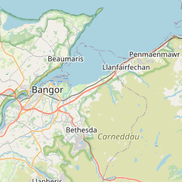
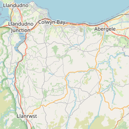
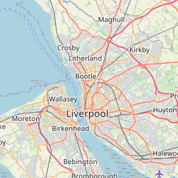
Relation: Conwy (297287)
Version #123
combined three identical sections of boundary in to one
- Edited by kerr smith
- Changeset #164073314
Tags
| ISO3166-2 | GB-CWY |
|---|---|
| admin_level | 6 |
| alt_name:en | Conwy County Borough |
| alt_name:ur | کونوی |
| borough | yes |
| boundary | administrative |
| council_name | Cyngor Bwrdeistref Sirol Conwy County Borough Council |
| council_name:cy | Cyngor Bwrdeistref Sirol Conwy |
| council_name:en | Conwy County Borough Council |
| council_style | county_borough |
| designation | principal_area |
| is_in:country | United Kingdom |
| is_in:country_code | GB |
| name | Conwy |
| name:ast | Conwy |
| name:bg | Конуи |
| name:br | Sir Conwy |
| name:ca | Conwy |
| name:ceb | Conwy |
| name:cs | Conwy |
| name:cy | Conwy |
| name:da | Conwy County Borough |
| name:de | Conwy County Borough |
| name:en | Conwy |
| name:es | Conwy |
| name:et | Conwy |
| name:eu | Conwy |
| name:fa | شهرستان مستقل کانوی |
| name:fi | Conwy |
| name:fr | Conwy |
| name:ga | Conwy |
| name:gv | Co-chorp Coontae Chonwy |
| name:he | קונוו |
| name:it | Distretto di contea di Conwy |
| name:ja | コンウィ |
| name:ko | 콘위 자치시 |
| name:lt | Konvis |
| name:nan | Conwy Chū-tī Kūn |
| name:nl | Conwy |
| name:nn | Conwy grevskapsdistrikt |
| name:no | Conwy |
| name:pl | Conwy |
| name:pt | Conwy County Borough |
| name:ro | Conwy |
| name:ru | Конуи |
| name:scn | Conwy |
| name:sco | Conwy Coonty Burgh |
| name:sv | Conwy |
| name:uk | Конві |
| name:ur | کانوئ |
| name:zh | 康威郡自治市 |
| official_name | Conwy County Borough |
| official_name:cy | Bwrdeistref Sirol Conwy |
| official_name:en | Conwy County Borough |
| ons_code | 00NE |
| population | 114,800 |
| population:date | 2021-03-21 |
| ref:gss | W06000003 |
| source | npe |
| source:ons_code | OS_OpenData_CodePoint Codelist.txt |
| source:population | https://www.nomisweb.co.uk |
| type | boundary |
| wikidata | Q817971 |
| wikipedia | en:Conwy County Borough |
Part of
1 relation
 Cymru / Wales (58437) (as subarea)
Members
97 members
 Way 730772374 as outer
- Way 126614985 as outer
- Way 42830548 as outer
- Way 272258179 as outer
- Way 272255969 as outer
- Way 207603634 as outer
- Way 207603637 as outer
- Way 272757254 as outer
- Way 272757239 as outer
- Way 42830681 as outer
- Way 42830675 as outer
- Way 42828516 as outer
- Way 30766584 as outer
- Way 816592422 as outer
- Way 816585743 as outer
- Way 816582486 as outer
- Way 816576509 as outer
- Way 816576507 as outer
- Way 825491566 as outer
- Way 816582487 as outer
- Way 816582483 as outer
- Way 825882613 as outer
- Relation Penmaenmawr (297354) as subarea
- Relation Conwy (5214736) as subarea
- Relation Llandudno (5216241) as subarea
- Relation Ysbyty Ifan (10105626) as subarea
- Way 816883433 as outer
- Way Nant Luke (816883432) as outer
- Way Afon Elwy (816970276) as outer
- Way 816970279 as outer
- Way 827633847 as outer
- Way 817315105 as outer
- Way 827595822 as outer
- Way Afon Ystrad (827590519) as outer
- Way Afon Ystrad (817315107) as outer
- Way 817315108 as outer
- Way 817315101 as outer
- Way 817315102 as outer
- Way 1348736356 as outer
- Way 1348736355 as outer
- Way 817315100 as outer
- Way 817315103 as outer
- Way 817315104 as outer
- Way 817329005 as outer
- Way 827581112 as outer
- Way 827570768 as outer
- Way 817337734 as outer
- Way 826594467 as outer
- Way 817329006 as outer
- Way Nant y Derwydd (817328993) as outer
- Way Afon Alwen (817328994) as outer
- Way 817328995 as outer
- Way 817341648 as outer
- Way Afon Alwen (817328996) as outer
- Way Afon Alwen (826573765) as outer
- Way Nant Lleidiog (817328997) as outer
- Way 817328998 as outer
- Way 817328999 as outer
- Way 817329000 as outer
- Way 817329001 as outer
- Way 817329002 as outer
- Way 817329007 as outer
- Way 822160687 as outer
- Way 822170229 as outer
- Way 822179673 as outer
- Way 817329008 as outer
- Way 818110677 as outer
- Way 818110676 as outer
- Way 1179833967 as outer
- Way 818143301 as outer
- Way 818143299 as outer
- Way 818152205 as outer
- Way 818152206 as outer
- Way 819042246 as outer
- Way 819049207 as outer
- Way 819121232 as outer
- Way 819121233 as outer
- Way 819121234 as outer
- Way 819121231 as outer
- Way 819146570 as outer
- Way 819146571 as outer
- Way 819146572 as outer
- Way Nant y Felin-fach (819146574) as outer
- Way 819146573 as outer
- Way Nant Fach (820205715) as outer
- Way 820205717 as outer
- Way 820205718 as outer
- Way 820205714 as outer
- Way 820237484 as outer
- Way 822229403 as outer
- Way Nant-y-llys (822304531) as outer
- Way Nant-y-Gwryd (822304535) as outer
- Way 822304536 as outer
- Way 822304534 as outer
- Way 822310239 as outer
- Way 822310238 as outer
- Way 827590522 as outer
Welcome to OpenStreetMap!
OpenStreetMap is a map of the world, created by people like you and free to use under an open license.
Hosting is supported by Fastly, OSMF corporate members, and other partners.


| https://openstreetmap.org/copyright | https://openstreetmap.org |
| Copyright OpenStreetMap and contributors, under an open license | |