Loading...
Node History: عتير (1077259656)
Version #7
Revert changeset 97227964
- Edited by zstadler
- Changeset #110808712
- Location: 31.3244570, 35.0273199
Tags
Version #6
Villages - OSM Israel
- Edited by deleted
- Changeset #99664779
- Location: 31.3244570, 35.0273199
Tags
| name | عتير |
|---|---|
| name:ar | عتير |
| name:en | Atir |
| name:fr | Atir |
| name:he | עתיר |
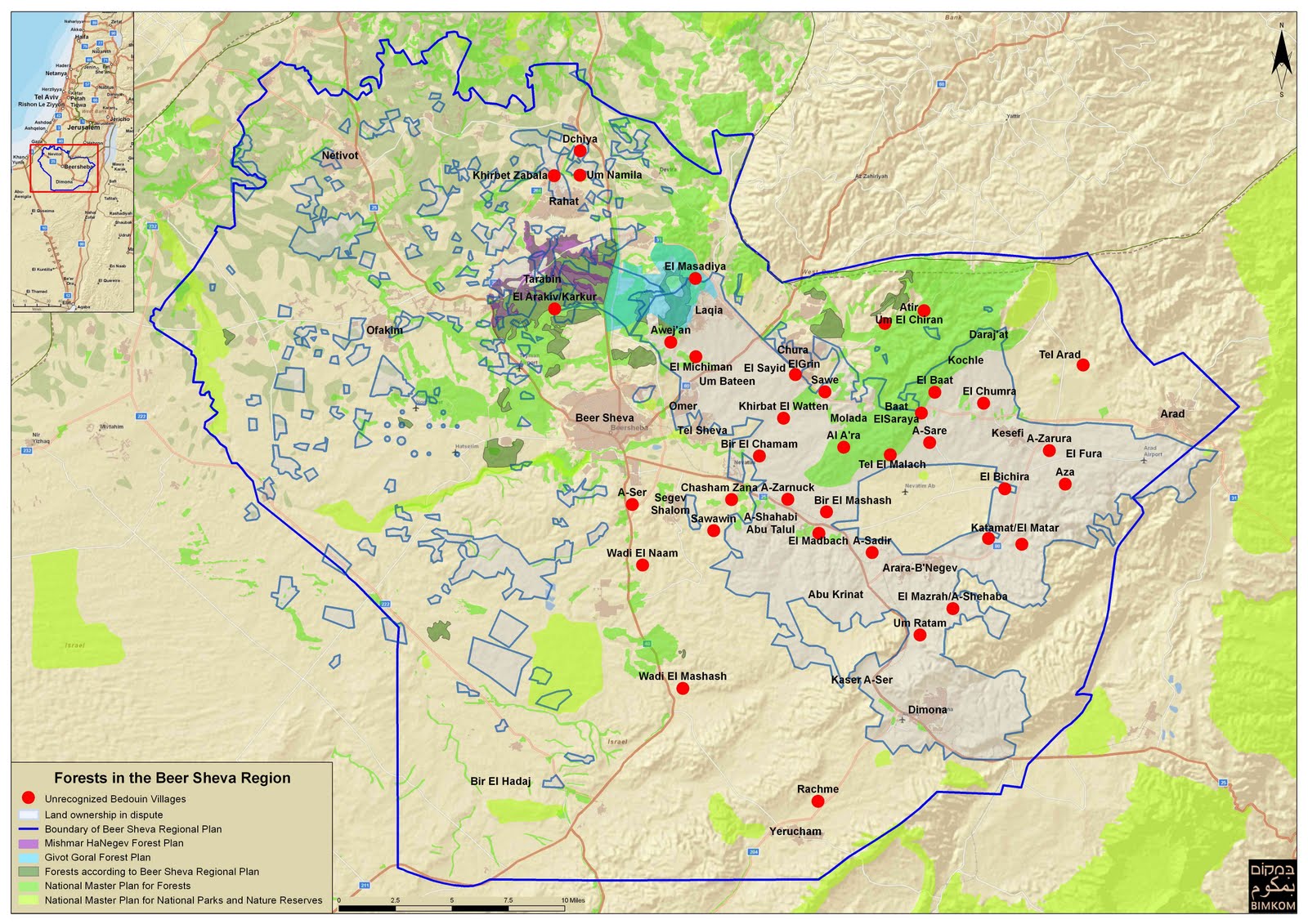
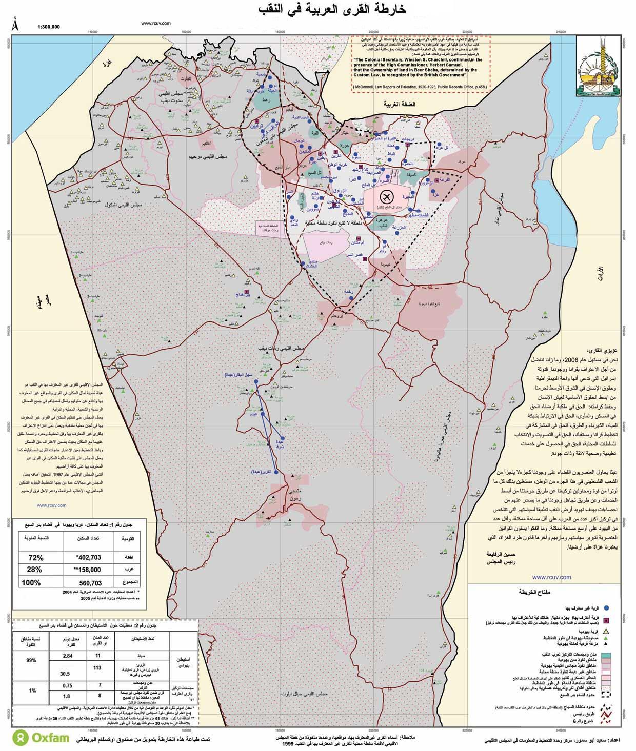
| note | This locality remains unrecognized by the State of Israel. |
| place | village |
| source | https://7amleh.org/ms/Links/2.jpg;http://ftpmirror.your.org/pub/wikimedia/images/wikipedia/ar/7/7d/Naqab-map-ar.jpg;https://zochrot.org/uploads/uploads/a4d148c2755d37acb6f3e20ea920d683.jpg |
Version #5
Part 2 (cities will be Part 3), South District update of localities, nametags, population, etc. only a node is to represent a locality. An area that shows residential landuse shouldn't show locality information. Unrecognized bedouin Settlements of Negev.
- Edited by NFZANMNIM
- Changeset #97218168
- Location: 31.3244570, 35.0273199
Tags
| name | عتير |
|---|---|
| name:ar | عتير |
| name:en | Atir |
| name:he | עתיר |
| note | This locality remains unrecognized by the State of Israel. |
| place | village |
| source | https://7amleh.org/ms/Links/2.jpg;http://ftpmirror.your.org/pub/wikimedia/images/wikipedia/ar/7/7d/Naqab-map-ar.jpg;https://zochrot.org/uploads/uploads/a4d148c2755d37acb6f3e20ea920d683.jpg |
Version #4
Arab localities; improvements; corrections
- Edited by سامبا
- Changeset #55687360
- Location: 31.3244570, 35.0273199
Tags
Version #2
Updating the name:he field for Israeli villages by request
- Edited by Mr_Israel
- Changeset #15315818
- Location: 31.3244570, 35.0273199
Tags
Welcome to OpenStreetMap!
OpenStreetMap is a map of the world, created by people like you and free to use under an open license.
Hosting is supported by Fastly, OSMF corporate members, and other partners.
| https://openstreetmap.org/copyright | https://openstreetmap.org |
| Copyright OpenStreetMap and contributors, under an open license | |