Loading...
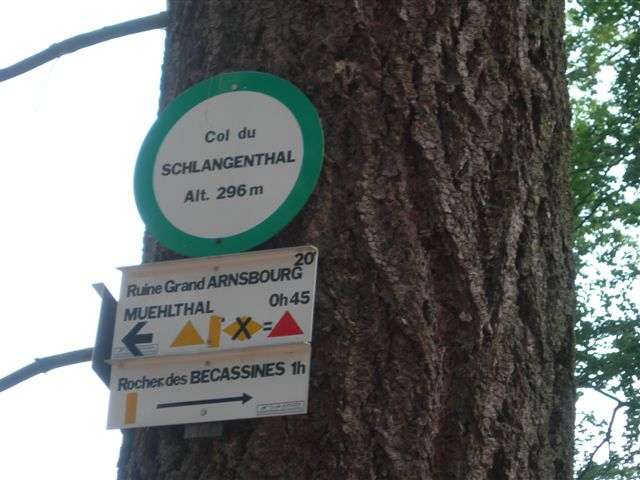
Node: Col du Schlangenthal (6161478739)
Version #3
added stuff around Philippsbourg, harmonization of source key values in the pays de Bitche, replaced occurences of "Vogesenclub" with "Karte der Vogesen im Massstabe 1:50 000"
- Edited by ThePierrasse
- Changeset #121533648
- Location: 48.9616043, 7.5656045
Tags
| description | Leizelthal 20' Philippsbourg 50' Ruine Grand Arnsbourg 20' Muehlthal 45' Rocher des Bécassines 1h ruine du Ramstein 1h45 |
|---|---|
| ele | 296 |
| image | https://nsm01.casimages.com/img/2009/02/20//090220070805180123183088.jpg |
| information | guidepost |
| name | Col du Schlangenthal |
| operator | Club vosgien Baerenthal |
| source | Club vosgien Baerenthal;survey |
| tourism | information |
Part of
2 relations
- Relation Red triangle (9149734) (as guidepost)
- Relation Red dot (9149735) (as guidepost)
Welcome to OpenStreetMap!
OpenStreetMap is a map of the world, created by people like you and free to use under an open license.
Hosting is supported by Fastly, OSMF corporate members, and other partners.
| https://openstreetmap.org/copyright | https://openstreetmap.org |
| Copyright OpenStreetMap and contributors, under an open license | |