Loading...
Way: Anna Paulowna-Den Helder (159752147)
Version #4
Maximumsnelheid 80 op rijkswegen: toevoeging tag maxspeed=80 #NWB2OSM
- Edited by JeroenvanderGun
- Changeset #149479191
Tags
| access | yes |
|---|---|
| bicycle | yes |
| duration | 00:04 |
| foot | yes |
| hgv | yes |
| horse | yes |
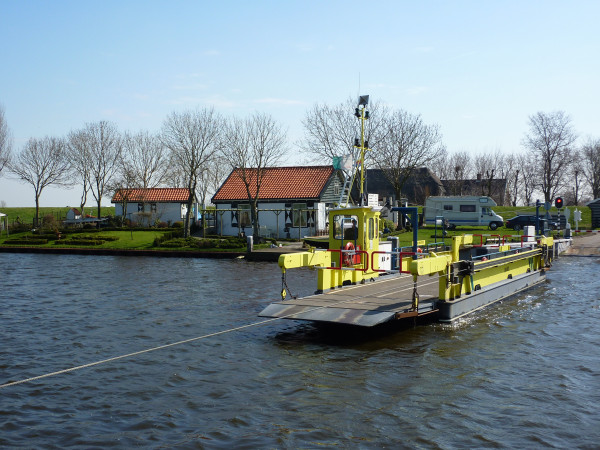
| image | https://veerponten.nl/wp-content/uploads/2018/05/julianadorp0004.jpg |
| maxheight | 3.5 |
| motor_vehicle | yes |
| motorcar | yes |
| name | Anna Paulowna-Den Helder |
| opening_hours | Mo-Fr 06:30-12:30,13:00-18:30; Sa 06:30-12:30,13:00-18:00; Su 09:00-12:30,13:00-18:00 |
| route | ferry |
| toll | yes |
| website | https://veerponten.nl/veren/anna-paulowna-julianadorp-den-helder/ |
Part of
3 relations
- Relation 71-72 (2835274)
- Relation Noord-Hollandpad - 04 (4675349)
- Relation 30-38 (11643845)
Nodes
2 nodes
- Pont Julianadorp-Breezand (47569843) (part of ways Molenvaart (1268365591) and 45136345)
- Pont Julianadorp-Breezand (47570576) (part of ways 6641579 and 45136345)
Welcome to OpenStreetMap!
OpenStreetMap is a map of the world, created by people like you and free to use under an open license.
Hosting is supported by Fastly, OSMF corporate members, and other partners.
| https://openstreetmap.org/copyright | https://openstreetmap.org |
| Copyright OpenStreetMap and contributors, under an open license | |