Loading...
Way: 166583905
Version #7
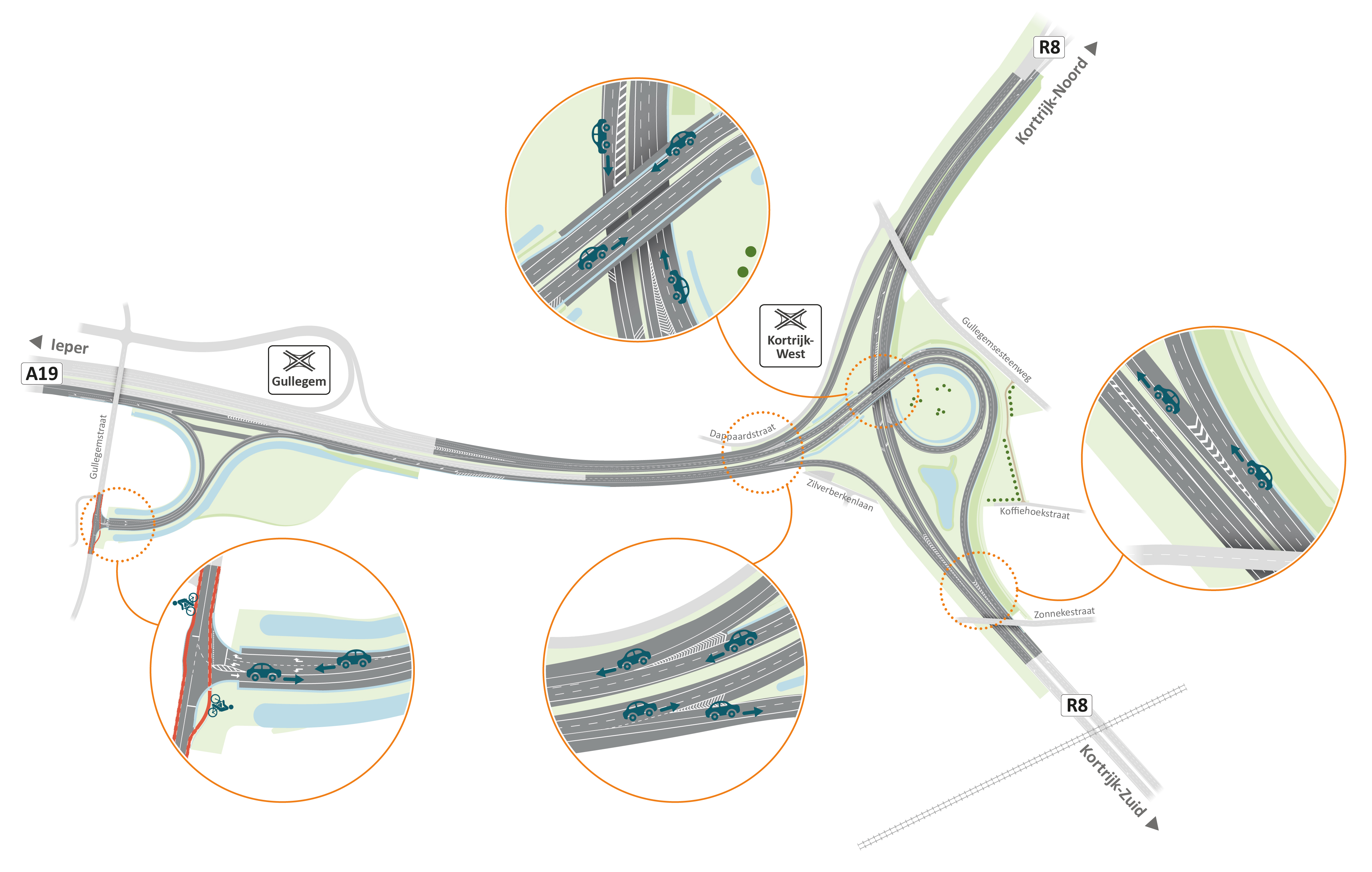
volgens https://wegenenverkeer.be/sites/default/files/images/2021-09-17_AWV_A19-R8_kortrijk_ontwerpkaart.jpg
- Edited by Geoffrey10
- Changeset #140676934
Tags
| destination:colour:lanes | ||;;white; |
|---|---|
| destination:lanes | Ieper;Menen|Ieper;Menen|Doornik;Brugge;Gullegem-Moorsele;Gullegem |
| destination:ref:to:lanes | A19|A19|E403 |
| destination:symbol:lanes | ||;;industrial; |
| highway | motorway_link |
| lanes | 1 |
| maxspeed | 90 |
| oneway | yes |
| surface | asphalt |
| toll:hgv | yes |
| turn:lanes | through|through|slight_right |
Nodes
10 nodes
- 1081813561 (part of way 8033997)
- 2650777555
- 60054647
- 1081813608
- 315295801
- 1081813924
- 32683426
- 315295802
- 33540713
- 1081813456 (part of ways A19 (1099377478) and A19 (637988815))
Welcome to OpenStreetMap!
OpenStreetMap is a map of the world, created by people like you and free to use under an open license.
Hosting is supported by Fastly, OSMF corporate members, and other partners.
| https://openstreetmap.org/copyright | https://openstreetmap.org |
| Copyright OpenStreetMap and contributors, under an open license | |