lxbarth's Diary Comments
Diary Comments added by lxbarth
| Post | When | Comment |
|---|---|---|
| OSM Awards as a thermometer on diversity in the mapping community |
This makes no sense and what makes you state your opinion in such an offensive way? We’re different from each other and it’s called diversity. We want basic rules in place to keep our interactions civil, precisely because there are comments like yours making people fell not welcome. |
|
| A Review of the Manifests of all OSM US Board Election Candidates | Edits aren’t required to serve on the OpenStreetMap US board. In fact some of the most valuable board members in OpenStreetMap US’ past haven’t edited much. The board isn’t about editing OpenStreetMap, it’s about supporting and growing OpenStreetMap in the US. It’s about our ability to put on awesome conferences, to run solid communications, to raise money, to keep our books in order, and to facilitate local events. As someone who’s served for 3 years on the board and does quite a bit of editing, I welcome anyone to the board who’s passionate about OpenStreetMap and is ready to put in real time. Great skills in organizing, communications, networking, fund raising and a passion for the project don’t always go with mad mapping kills :) Everyone is welcome. I’m personally thoroughly impressed with each person who I’ve been on the board with this past year and each new candidate running this year. As jonwit pointed out, there’s a townhall recording from last night to learn more about the candidates. Cheers! |
|
| Data issues in Japan | @SK53 - y, this needs to be translated, working on it. Note that we’ve been in touch with the Japanese community from the get go on this project, with Taichi Furuhashi being extremely helpful - there’s a Facebook coordination page and continued communication in Japanese: https://github.com/mapbox/mapping/issues/120#issuecomment-140966601 |
|
| San Francisco data imports, anyone? |
Andrew - note that Bing imagery is not the authoritative image reference for OpenStreetMap as it can be off in bad cases by meters. In the San Francisco tracing effort we have used existing GPS data and the LIDAR derived SF public domain building dataset as location reference. http://wiki.openstreetmap.org/wiki/Good_practice#Align_Aerial_Imagery_before_Tracing |
|
| San Francisco data imports, anyone? | I love this. The building dataset for SF in OSM is one of the best out there, it would be great to add building heights right into it. |
|
| Natural Atlas + OpenStreetMap |
The terms don’t seem they’re globally forbidding vectorizing the map, although it would be good to define what specific latitude/longitude coordinates are meant in the ToS.
This is not the case. Placing markers on top of an OSM based map doesn’t per se make the marker locations subject to ODbL share alike. Only if you used those markers in a way that winds up extracting a Substantial subset of OpenStreetMap the marker data would be subject to ODbL share alike. |
|
| Did somebody delete Hyderabad, India? | Nice find. I added a rudimentary city node until the original one is recovered http://www.openstreetmap.org/changeset/31950230 Please report such issues to the data working group (data@osmfoundation.org). I just notified them of the issue. |
|
| How we apply map feedback | Hit send too early, continuing: We’ll also have to balance driving editors with the goal of knowing what’s wrong on the map. We only have a seconds of a user’s time to learn what’s going on, so we’re keeping this experience laser focused. Since we flipped the form around and offer a fast submission first we’ve increased the number of reports we’re seeing at least by 10 x. I’m seeing we lost the piwik link on the edit button so I can’t report on users we drive (getting this one back in now). Everybody’s OpenStreetMap relevant knowledge going through map-feedback winds up on the map: either as a direct edit by the Mapbox team, as a note or by a direct edit by the user. |
|
| How we apply map feedback |
Adding to this: a previous iteration of the map feedback page was flipped around: the first action was “contribute to OpenStreetMap”, the second action was “let us know what’s wrong”. This didn’t work as well as we wanted to. Only a minuscule amount of visitors wound up going to OpenStreetMap (we don’t know whether they actually edited). We’ll continue to measure the impact of this page and iterate on it. Overall, driving editors to OpenStreetMap is the best thing for the project - we all agree on that. |
|
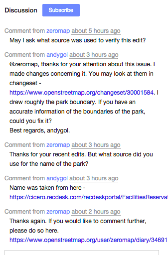
| _ | Alex from Mapbox data team here - thank you for the detailed write up! We typically verify incoming feedback against a second source - the bulk of it can be checked against Satellite imagery (“missing path” type of info) or like here with a municipal web site’s information. Information we can’t verify we place as notes. I’ll touch base with my colleague Andgol first thing tomorrow and get back to you with more details of what happened here.
Love btw how we can have conversations directly on the changeset now thanks to changeset comments. Together with notes this functionality really helps us interact with community outside of our team right now.
|
|
| Rückblick auf die FOSSGIS 2015 in Münster und Ausblick auf die Zukunft der FOSSGIS | Danke für die Zusammenfassung!
Fänd ich gut. State of the Map Berlin 2016? :) https://blog.openstreetmap.org/2015/03/10/call-for-venues-for-sotm-2016/ |
|
| Hamlets in US cities | In my experience you’ll find three types of
I suggest the following fixing strategy for all hamlets in populated areas:
This is the rule I’ve been personally following. How does this sound? |
|
| Fixing the rural US |
Interesting idea… |
|
| Fixing the rural US |
And y, we should be able to detect these types of issues w/ HPMS/ARNOLD. |
|
| Fixing the rural US | @RichardF - yup, thought about it… but: what we have of ARNOLD right now is pretty much what HPMS (attributes) is using of ARNOLD (geometry) - which isn’t much. OSM or TIGER coverage is much much bigger than HPMS, and ARNOLD itself is not available for download, I think. Let me check on the latter, actually. |
|
| Fixing the rural US | Richard - thanks for posting. Over here in the Mapbox team we’ve been mostly focused on fixing alignment problems via the micro tasking manager to-fix (background). We’re using updated TIGER data as a guide for editing, one weakness of the original TIGER data is the lack of classification granularity in the lower level road network - exactly the reason why we have this mess in OSM now. Just talked to Eric Fischer over here and we want to look into whether by surfacing the existing road classification in TIGER comparison layers better we can at least focus retagging efforts better by knowing where TIGER does / doesn’t provide useful classification information. I like the framework you’re suggesting for retagging. Some other useful tools for fixing TIGER:
|
|
| Japan, why are you so beautiful? |
Haha, yeah, bad photoshopping :) |
|
| Now Live: Notes Posted By Scout Users | This is awesome. |
|
| Website for asking to improve just one area in OpenStreetMap (or paying for improvement) | I’d love to be able to put a bounty on notes I’d like to see addressed. Paying small bounties like this could be interesting to incentivize on the ground surveys where work can’t be done remotely. |
|
| Why I'm running for OpenStreetMap US again | Eric Fischer does all the magic! https://www.mapbox.com/blog/osm-community-visualized/ |