OpenStreetMap logo OpenStreetMap

Harry Wood's Diary

Recent diary entries

A missing zoo!

Posted by Harry Wood on 11 April 2016 in English.

I just got back from a holiday in Brazil. We were over there with the new baby, so we hadn’t planned anything too ambitious travel wise. Just visiting the family in São Paulo. I should say in Guaruhlos, which is a smaller big city inside of, or outside of the massive city of São Paulo, depending on who you ask (It’s really all part of the same sprawling concrete jungle)

So I didn’t manage to organise an OpenStreetMap meet-up this time, but while changing nappies and bumming around on the internet I took at a look at the attractions of Guaruhlos according to various internet listings. There aren’t many, but there is… a zoo! My wife didn’t even know about it and neither did wikivoyage… neither did OpenStreetMap :-O

Of course I insisted we go there, and so now, to my surprise, I have had the opportunity to bag a missing zoo in OpenStreetMap! Naturally I also had to map out all the different animal cages. That’s the standard OpenStreetMap zoo treatment which the Berlin Zoo mappers started I think. I haven’t mapped the details quite down to Edinburgh Zoo levels, and some of my positioning of things under the trees may need a bit of tweaking, but… behold Zoológico Municipal Guarulhos!

Zoológico Municipal Guarulhos

The tag for the different zoo animals seems to be tourism=attraction + attraction=animal. and the name tag for the name of the animal of course. Which would be weird if you just plotted a map of where all tourism=attractions are :-) I put Portuguese names in (from the zoo signs) but also name:en tags so you can have an english map of the zoo if you want.

I also added the zoo to WikiVoyage’s ‘Guarulhos’ page. WikiVoyage has some quite nice OpenStreetMap integration these days. You can easily set coordinates on all the listings, and they appear on a marker map. Not sure how long that wikimedia base-map takes to re-render, but… tourists don’t visit Guarulhos very often. When they do, we’ll be ready!

I’m back in London now without my wife and baby for two weeks. I’ll miss them terribly of course but… I’M FREE! Time for some London pub meet-ups!

Location: Jardim Rosa de França, Vila Galvão, Main District of Guarulhos, Guarulhos, Região Imediata de São Paulo, Região Metropolitana de São Paulo, Região Geográfica Intermediária de São Paulo, São Paulo, Southeast Region, 07081-060, Brazil

Amazing what some professional video editing can achieve. I had a fairly long waffling chat with Jonathan Cronin, and he’s sliced out the good bits, overlaid some photos, etc, to turn it into this video:

harry-wood-ivan-gayton-video

In the background behind me is the Future Cities Catapult offices where I work some of the time. Some of the cutaways are to itoworld’s animated edits globe videos

Of course, he’s also interviewed Ivan Gayton from MSF. (Incidentally I recently posted my own video of Ivan as he described the Kunduz hospital bombing at a missing maps meet-up. Zero attempt at editing that one)

The video title “OpenStreetMap: The map that saves lives” suggests that this is all about humanitarian stuff, but if you watch the video, you’ll see we’re describing OpenStreetMap in general. OpenStreetMap and Humanitarian OpenStreetMap Team Together. Jonathan asked lots good general questions and seemed to understand some of the deeper issues and motivations of OpenStreetMap, and included this in the final cut. This makes a nice change. Over the years I’ve seen spikes of media interest (TV appearances and everything!) always about humanitarian OpenStreetMap, never so much about the bigger idea of making a free and open map of the world.

I’m also pleased that the video clearly shows how these stories flow into each-other nicely. It even ends with Ivan, a senior aid organisation figure, talking about the business impact of OpenStreetMap! And why not? It’s all the same story. It’s a brilliant story which we should all share in and be proud of together. OpenStreetMap old-timers should enjoy their part in the story of how we built a community and mapping platform which was capable of responding the way we did for Haiti, almost by accident. A spontaneous thing which later gave rise to HOT. We should also celebrate the fact that we are creating the very first maps of the developing world, and we are doing it as open data, starting these people’s maps off with a strong free & open footing, where otherwise the big G would probably conquer the territory first.

So this video popped up last week. And around about the same time recently, I published my talk, given at the Missing Maps meet-ups, about mapping your own neighbourhood.

Mapping Your Own Neighbourhood slide1

That’s a coincidence, but very much part of the same idea of stitching together the humanitarian mapping story with the overall OpenStreetMap story. Humanitarian mappers should look back at the history of OpenStreetMap and consider themselves part of this great endeavour to create a free map of the world (and make efforts to be a part of it more, by mapping your own neighbourhood)

But the timing of these is a fortunate too, because I see various folks recently creating/highlighting divisions between OpenStreetMap and the Humanitarian OpenStreetMap Team. Discussions around the orientation of OSMGeoWeek event listings, and the use of changeset comments coming from the OSM Tasking Manager, seemed to quickly illustrate that these communities have divided far more than necessary, and we really just need to talk to each-other more. Speaking as somebody who has always had a firm foot in both places, I find it frustrating that it’s not just a simple friendly collaboration. (This is before I even mention my despair at recent OSMF mailing list discussions)

But its OK because…

“Since giving this talk, everyone in the OpenStreetMap community is following my advice, and a new spirit of harmonious cooperation has settled over the project…” (echo from a 2009 blog post. Pigs might still fly). But seriously though. I know there’s real issues in these discussions. Issues we should work through. But they can get blown out of proportion. I hope this video and my talk are useful illustrations that OpenStreetMap and the Humanitarian OpenStreetMap Team are a friendly cooperative parts of the same whole. Let’s not be imagining otherwise. They are all part of the same brilliant story. I, for one, will continue to enjoy telling this story, every chance I get!

Hoxton, Brixton, and lots of data entry + Holborn tonight!

Posted by Harry Wood on 4 September 2014 in English. Last updated on 5 September 2014.

Last weekend I decided to ignore all my most pressing todo list items, chill out, and catch up on some mapping (Putting in map data based on all the photos I’ve collected) I’ve been getting behind on this, which gives me a familiar “really need to get around to doing that” feeling. That goes for everything on the todo list, but I allow mapping to jump to the top sometimes because the truth is, it’s nice and relaxing. I was in the mood for some long JOSM sessions last weekend so…

In went the data from the 14th May Baker Street mapping evening. Boom!. This was an event which I have actually already managed to write a diary entry about at least, but apologies to Marco, who may have been wondering why we didn’t seem to improve the map at all. Now we have (3 months later!)

In went my data from the 23rd June Hoxton Square mapping evening. Boom!. Actually other people had already got most of that data in, so I was just following up with A few additions and refinements around the square, and the block to the West of it.

This was the mapping evening featuring a radio reporter who followed us around and shoved a big microphone in our faces while we explained what we were doing.

The result of that was broadcast on an american radio station, and is also available to hear here: From Pen And Paper To 3-D, Look Who’s Challenging Google Maps. As often seems to be the case with these media appearances, it got very heavily edited down. I was cut completely. It just had a few phrases spoken by Robert, recorded while we were out mapping that evening. These soundbites and the commentary portray OpenStreetMap as rather a tin-pot project for crazy nutters, but… ah well… Any publicity is good publicity.

And we went to the Reliance pub in Shoreditch. This pub is an old favourite of my officemates at the Open Data Institute. That evening the world cup was on, and Brazil were still doing well (to flop out spectacularly in their next game)

flickr

In went the data from the 23rd Jun Brixton mapping evening. Boom!. This was a really nice sunny summer evening mapping session, so I got lots of photos of shops, and keying in all this data last weekend took me a long time. Quite interesting shops though, we were exploring the indoor markets and all the other dinky little afro-carribean/jamaican shops in the area. I’m sure there’s lots more shop mapping to do in the area though.

flickr

I enjoyed the sunshine. Along with photoing shops, I was trying to get some mapping action photos. I enjoyed having along Taichi who is one of the main OpenStreetMap community leaders in Japan, and Richard Pope who works for GDS and I’ve met at lots of hackathons (hope we can get him interested in OSM dev):

flickr flickr

And I enjoyed the burritos. Most of all I enjoyed leaving some things for somebody else to organise. Thanks Robert!

That was a lot of mapping data entry, but I still need to input some data from our recent Mayfair mapping evening. Still playing catch-up. Perhaps it’s a good thing then, that our next meet-up is just a nice relaxed pub meet-up. And when is this next meet-up happening? I shall tell you…

TONIGHT!

It 20 minutes the social OpenStreetMap drinking commences at the Penderel’s oak in Hoborn (details). Come join us!

Location: Stockwell Park, Stockwell, London Borough of Lambeth, London, Greater London, England, SW9 0DA, United Kingdom

OpenStreetMap birthday weekend (including wikimania etc)

Posted by Harry Wood on 20 August 2014 in English. Last updated on 31 August 2021.

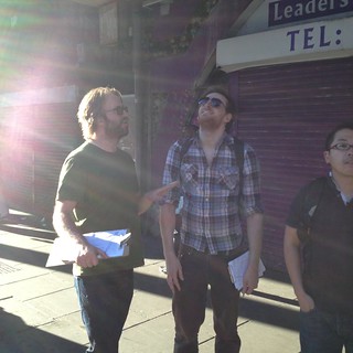
Tonight we’re heading out mapping again! Join us for a London mapping evening in the Bond Street/Mayfair area.

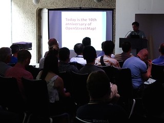
I’m not doing very well at catching up with my diary entries on all the interesting things which have been happening. Since my last diary entry more things have happened, mostly all in one weekend! The weekend before last it was the OpenStreetMap 10th birthday party of course, but for me at least, that was not all:

  • Friday - Open Addresses Symposium
  • Friday night - wikimania entertainment
  • Saturday a.m. - wikimania OpenStreetMap sessions
  • Saturday midday - appearing on sky news
  • Saturday p.m. - OpenStreetMap birthday pub!
  • Sunday a.m. - breakfast with Frederik
  • Sunday - more wikiania sessions

The Open Addresses Symposium was an event put together by the Open Data Institute who have got funding to implement an Open Addresses project (dataset / software / community). In the UK we had an opportunity to make Royal Mail’s Postal Address File an open dataset (Why? Because it’s infrastructure. Make it free and open, and all kinds of innovation are quietly but obviously enabled) Instead our government recently sold it off as an asset along with the rest of Royal Mail, and this publicly-owned dataset was lost forever. Stupid. PAF was the topic of an open data campaign for years. It’s ended badly, but on the plus side it means we can write that off and move on. So at the Open Addresses Symposium, a couple of hundred address data experts and corporate users gathered to discuss this, and the idea of creating Open Address data. Steven Feldman has a write up here. The actual plan wasn’t laid out yet (discovery phase) but it will probably involve joining together various open data sets in clever ways, combined with some “crowd-sourcing” element.

Jerry and I were there representing OpenStreetMap. Being so busy lately I was grateful to not be doing a talk. Jerry did a great job of this:

on flickr

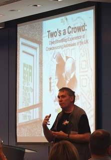
When it comes to OpenStreetMap there’s two big bits of bad news: (1) In the grand scheme of things we have data on only a tiny proportion of addresses in the UK (2) Our data has share-alike restrictions which this project would be aiming to avoid. But Jerry talked up the positives, and in particular the fact that OpenStreetMap community has a lot of experience (and open source code) in the “crowd-sourcing” side of things, on-the-ground surveying, and crazy JFDI approaches in general.

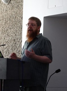
There was also a talk from the legendary Bob Barr. Always with an enjoyably passionate presentation style which gets the audience excited. I remember first seeing him give the opening talk at State Of the Map 2008, in which, coincidentally, he passionately argued for liberating address data sets!

Some good conversations with people in the pub afterwards too, but then I had to head off to…

Friday night - wikimania entertainment. I wanted to start taking in the buzz of wikimania. It is a buzzy kind of conference with a lively community, much like State Of The Map, only three or four times the size! Actually the buzz on Friday evening at the Barbican was a bit subdued. I suspect the real party was in a pub somewhere. I did however bump into some OSMers, Tim Waters, Edward Betts, and Paul the Archivist. There was a screening of the movie about Aaron Swartz which was inspiring, thought-provoking, and a bit depressing (available to watch on youtube there) Mostly it made me think “oh that’s what that SOPA thing was all about”. Maybe I should’ve paid more attention at the time.

Saturday a.m. - wikimania OpenStreetMap sesssions. Back to the wikimania venue the next day (which was looking a lot more lively) to catch the sessions about OpenStreetMap.

Andy Mabbett gave an introduction to OpenStreetMap for wikipedians. I realise I’ve probably now given more talks introducing OpenStreetMap, than I have seen other people’s talks doing so. It was interesting to see his way of explaining the project to a semi-technical audience. Very rich with examples of different map displays from Birmingham (and from the mappa mercia site), and “guess what this map is showing” audience participation. He also touched on some ways that we can look to link wikipedia articles to OpenStreetMap elements.

on flickr

Great to meet User:Seav. He’s setting up OpenStreetMap Philippines, but was over at the the wikimania conference and giving a talk about various collaborations between OpenStreetMap and Wikipedia. He went into some thorny license issues around (not) cross-sharing geo-data between the projects, which prompted some questions. I thought he did a great job answering all of these. It was one of those Q&A sessions where the audience is left in no doubt that the speaker really knows their stuff.

on flickr

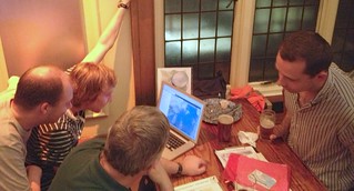
After that Katie Filbert was running a HOT mapping workshop, apparently this went well but with some troubles due to poor wifi. I had to duck out just at the start of this unfortunately because I had to get to…

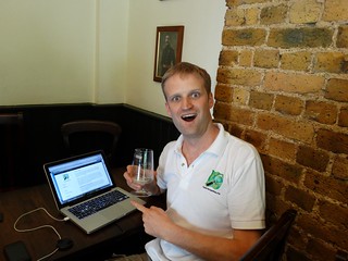
Appearing on sky news. This has to be one of the most bizarre experiences of my life. The day before I had a few emails and was suddenly lined up to be giving an interview about H.O.T. and our ebola response mapping. It seemed to be a live TV interview, but I wasn’t 100% sure until I got there. I headed over to the sky news studio at an address by the houses of parliament, which turned out to be a very grand old building entering via a cavernous wide stair-case. I saw an office full of desks and a big news studio type thing, but nobody around apart from one bloke who let me it. He was on the phone to their other studio and merrily led me past the office and into small dark cupboard. He sat me on a chair with TV camera pointing at me, and a small TV in the corner. His instructions were to “watch the monitor, then look at the camera”.

After a minute an ordinary newsreader woman appeared on the TV, except that she was picking her teeth and getting ready, which was a strange thing to see. Then suddenly, at 12:30 I suppose, she was reading the news headlines, and I was watching the very ordinary looking news as I relaxed sitting in my dark cupboard. Then she said “here with me now is Harry Wood from the Humanitarian OpenStreetMap Team” at which point I suddenly thought “ooh that’s me! look at the camera! look at the camera!”. I answered some questions about OpenStreetMap, and how MSF and Red Cross are using maps. Not sure if I got the key points across very well (fairly sure I didn’t in fact!). It felt like less than a minute and it was all done and dusted. Left the studio. Out into the sunshine.

I should’ve taken a photo of the news studio to prove I was there. Since then I haven’t been able to find an archive of the news online anywhere. One person on twitter said she’d seen it, but aside from that I have no evidence that my appearance on Sky News wasn’t just a weird daydream!

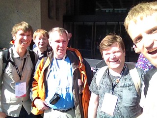
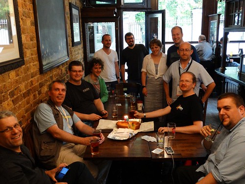
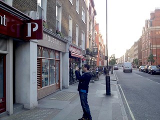
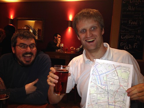
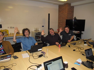
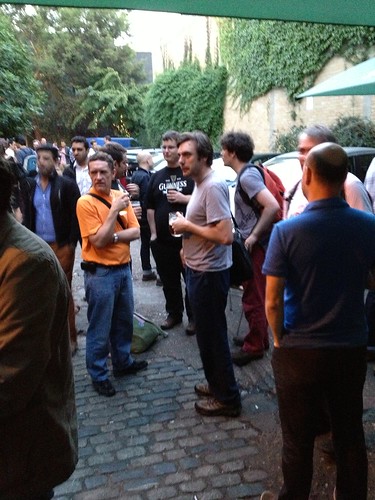
No time to ponder that though. I had to get back. I snapped this photo then got the tube back round to the barbican just in time to miss the end of the HOT mapping session! Worth getting back to appear in the wikimania group photo though. Also the OSMers at wikimania group photo:

on flickr

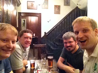
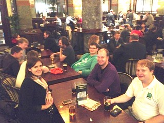
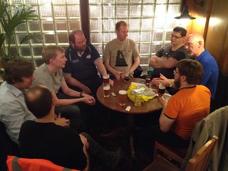
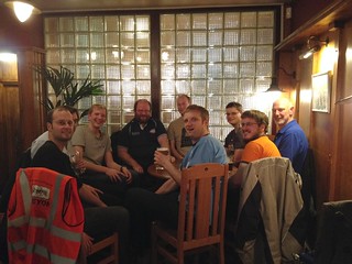
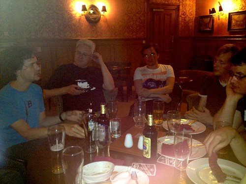
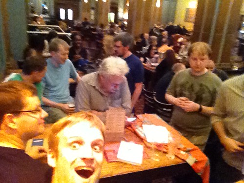
OpenStreetMap birthday pub! This was the main action of the weekend of course, although for me I was looking forward to chilling out with a beer after all the excitement. In the run up to this weekend I’d been bombarded with all sorts of the OpenStreetMappiness. I haven’t even had chance to mention how I was sent to Washington for H.O.T. the weekend before. Craziness! All of which meant I hadn’t had chance to do any spectacular preparation for the 10th OpenStreetMap birthday. Dan had a few ideas, and worked on putting out a press release (thanks!). When I sat down in the pub, I needed to finish writing a blog.openstreetmap.org blog post!

on flickr

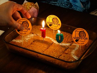
I was imagining I’d get time to do this before many other people arrived, but actually (despite me largely failing to promote the event properly) we had a lot of people coming along, and from quite early after the 3 o’clock drinking kick-off. Good show everybody! Also I was sad to have failed to organise any cake, but who needs to organise when we have a surprise distributed doacracy in action. Matt showed up with cake to make things OSMbirthdaytastic!

on flickr

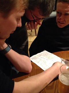
Let’s just take a closer look at that.

on flickr

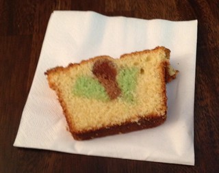
He was attempting to bake an OpenStreetMap logo through the middle of the cake! Looks a bit squashed, but it kind of worked. Good effort! Robert also got cake-creative. He was also worried we might not have a cake and so rapidly baked a parkin style cake with the Thames river icing sugar design sprinkled based on OSM map data of course.

on flickr

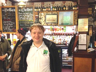
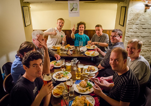
The choice of venue worked pretty well in the end. The Artillery Arms pub is pretty tiny, but as I had hoped, it was mostly empty at 3 on a Saturday, so we were able to rearrange tables and essentially take over half the pub. The take-over was complete when Dan wrote a birthday message on the blackboard behind us! And our numbers were swollen in the evening as people finished at wikimania nearby and popped over to join us.

on flickr on flickr

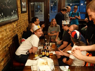
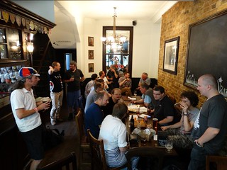
I should’ve got a better photo of the whole crowd, but I reckon we probably had 25 or 30 people there.

Of course… I was very drunk at time. Luckily Frederik was staying with me, so he could carry me home.

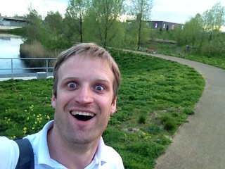
Frederik was also treated to some glorious english summer weather as we headed back to wikimania the next day. Despite having umbrellas, we got absolutely soaked on our lower legs. So yeah Sunday I was sat watching some wikimania talks with soggy trainers, feeling hungover. It reminded me of that time when I fell in the canal at SOTM Amsterdam… but that’s another story.

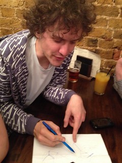
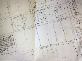
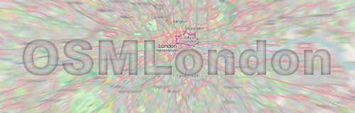
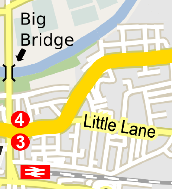
So yes. That was one hell of a weekend! But things are back to normal now. No cake at tonight’s pub (unless someone surprises me again!) but we do have a cake diagram! Edit that page to grab a slice of cake, if you want to help nail those Mayfair building outlines once and for all (is it ever going to happen?) Or just come to the pub from 8pm. All the details on the wiki for tonight’s event

[update: Just came across this nice write-up of the birthday pub by seav]

Location: Saint Luke's, Finsbury, London Borough of Islington, London, Greater London, England, EC1V 3RQ, United Kingdom

There’s going to be a good old London OpenStreetMap pub meet-up TONIGHT at the Monkey Puzzle in Paddington.

When was the last time I wrote a diary entry about London event happenings? A couple of months ago! The Baker Street mapping party. And I still haven’t input the data from that one! What can I say? Things have been busy. I’ve been busy at work. Lots of transportAPI shenanigans, including moving office to Euston. And busy at home. It turns out getting a new carpet involves moving… everything. But I’ve been busy with quite a bit of OpenStreetMap stuff too:

  • Pub meet-up Artillery Arms Bunhill fields
  • Introduced HOT project ideas to UCL students
  • Gave HOT talk at Start Network
  • Mapping party around Hoxton Square
  • Gave talk about UAVs & HOT’s OpenAerialMap project
  • Mapping party in Brixton
  • HOT meet-up at the ODI
  • Gave a talk to people at Exprodat
  • Geomob last week

In amongst all of that I’ve been trying to keep up with some Communication Working Group things and trying to organise meetings to get some new people to help. Pheweeee. Lots going on. The biggest thing on the OpenStreetMap calendar recently, SOTM EU, I missed because it clashed with my wife’s birthday, but… well I have not been feeling deprived of OpenStreetMap events!

The other day at geomob I was reminded of my last diary entry by the guy behind what3words… I don’t think he was too annoyed with me.

Shall I try to catch up on diary entries? Well I have notes for all these things, so I feel like I should really, but it’s a lot to catch up on. Let’s make a start.

So way back at the Artillery Arms pub meet-up (end of May!) I’ve just found my notes. Dan was scribbling on them as he showed us how to find the most remote branch of Starbucks in the UK using delaunay triangulation (and OpenStreetMap data)

flickr

Intially we were having some beers while looking out onto the bunhill fields cemetery (or is it a graveyard) and wondered whether all the famous people’s gravestones had been mapped. Turns out not! Maybe we should’ve mapped them, but this was a lazy pub meet-up.

We had an appearance from Ed Freyfogle with his baby! We also had an appearance from a radio journalist who was scoping things out for an interview/recording, which he did later at the Hoxton Square meet-up… but more on that later.

flickr

We talked about Notes. Someone suggested a routing system which brings you to your destination via some nearby notes! Quite a fun idea. I think there’s more “low hanging fruit” ideas around a more basic (highly specialised and simple) notes app, for viewing/adding notes on the move. In fact that’s on my list of hacks I would do if I could only get around to them.

In fact me and Matt solved a note on the way home. Solving notes is so easy you can do it while under the influence of alcohol!

Maybe we’ll do a bit of that again tonight, as we head to the pub again. If you’d like to join in with such activities (and pub conversations) we’ll be in the Monkey Puzzle, Paddington from 7pm. All the details on the London page

Location: Saint Luke's, Finsbury, London Borough of Islington, London, Greater London, England, EC1V 3RQ, United Kingdom

Baker St Mapping evening + Artillery Arms Tonight

Posted by Harry Wood on 29 May 2014 in English. Last updated on 4 July 2014.

We’ve got a London OpenStreetMap pub meet-up tonight! Join us in the Artillery Arms from 7pm. It’s just a social pub meet-up. We’re alternating, so last time was a “mapping evening”.

A couple of weeks back we did a bit of mapping around Baker Street. When I say “we” I mean me and Marco. He turned up at the designated meeting place, which was a surprise. But then we failed to find someone else who was supposed to be joining us for a walking talking mapping demonstration. Turns out she was actually there, but somehow didn’t find us. I was loitering outside a bank, wearing an OpenStreetMap Polo shirt and clutching a leaflet, but next time I need to make sure everyone has my mobile number.

But luckily Marco was there, so we were “go” for a mapping session. A couple of weeks back it felt like the height of summer, and so it was very pleasant to be wandering some quiet backstreets in the evening. I demonstrated taking lots of photos of shops and buildings, and then I took some photos of Marco taking photos of shops and buildings.

flickr

We took a snaking route which took in a few roads full of shops, and lots of higgledy piggledy buildings with funny shapes backing onto quiet cobbled backstreets.

flickr

Then we went to the pub! The metropolitan bar. It was quite a quiet meet-up. Just five or six of us. Actually there was one more new person who tried to find us at this stage, and again failed to find us for whatever reason. She was someone who works for what3words, so it was probably a good job she wasn’t there, because we weren’t being all that complimentary about it.

We were discussing it because it was presented at geomob the night before. what3words is yet another idea for a scheme to locate things, kind of as an alternative to the postcode. There are many such ideas to choose from, so whenever anyone comes with a new one, put on your skeptical hat. It had better be good, otherwise why not use one of the many other schemes? So the nice unique selling point of what3words is the readability and memorability of describing a location with three words. Good idea, but sadly what3words scores some pretty big fails. There’s some subtle points, like maybe it should be hierarchical with similar word combinations representing nearby locations. Some not so subtle points, like it requires access to a database of word location mappings. They could have designed it to be algorithmically reproducible for compact offline use, but the word location mappings are arranged within a database instead. This makes for some advantages, e.g. city locations use easier shorter words, while longer words are used for offshore locations. But of course the main advantage is for them. The old API lock-in chestnut. And no, the database is not open data. I’m afraid that’s a massive FAIL. There’s no way I would ever recommend using a system like that over and above a free and open scheme (of which there are many to choose from). Sadly they go beyond this fail, and also have patented the what3words idea, so now nobody else can do it better which is a shame.

Better alternative? OpenStreetMap shortlinks is one which has been around for a while. e.g. http://osm.org/go/euu6FOXvg?m A simple geohashing algorithm resulting in nice simple short links. It’s pretty awesome, and not really celebrated enough. Matt was at the pub to join in this discussion. He was keen to stress that he designed shortlinks to solve a different problem (making map links short!) but OpenStreetMap shortlinks are an awesome way of sharing a location in lots of ways. Chief among the advantages: it requires an algorithm not a database. I often joke (half seriously) that we should push for adoption of shortlinks to replace postcodes. We got onto discussing how Ireland doesn’t have postcodes (??!). Probably the main reason for this is that there are too many proposed schemes to choose from. OpenStreetMap shortlinks are the best though. I think I’m going to start sending all mail with shortlinks written under the address :-)

We talked about 3D buildings complications. How to map a thing on the 2nd floor of a building spanning over the top of a row of shops? That sort of thing. Personally my answer is to not really worry about it too much. If it’s getting too complicated, just map things as nodes within a building, with a level tag. But maybe that’s just me being sloppy.

We talked about searching for “Kings X”

We talked about android routing.

We talked about WheelMap.org and we classified the pub we were in, but this immediately threw up the usual problem I have, of deciding just how wheelchair accessible a place is or isn’t. But anyway we all agreed that wheelmap is awesome, and is perhaps the best example of an topic-focused data collection application using OpenStreetMap as the back-end. We need more of these!

We talked about the curious situation which is developing, as a number of “sister” organisations (H.O.T. and OSM France, and maybe OSM U.S.) are starting to move money around on a much larger scale than the core OpenStreetMap Foundation. This is weird and maybe a bit annoying for the people who are worrying about the core OpenStreetMap servers. We have a lean small organisation which raises a bit of money in donations, and makes income from running an annual conference, and then spends a bit of money on server hardware. Mostly though, in the grand scheme things, OSMF doesn’t move much money around. [Edit. I originally used the word “satellite” organisation, but that has a confusing double-meaning in OSM context]

I’m not sure of the details of OpenStreetMap France, but I know they attracted some large number of euros of funding, and one result we see is spending on OpenStreetMap France servers which run various things, particularly various services set up by Christian Quest. Not sure if Christian draws any salary on that. It would be interesting to know more about their financial situation. I do know more about H.O.T.’s finances. There’s a full time employee Kate Chapman, and a few others in Indonesia. So that immediately makes it seem as though H.O.T. is flush with cash, but actually the majority of HOT’s income is from projects, and the majority of employees time is spent working on these projects. A lot of income is “grant” funding. I guess the OSM France money was the same. Important point about this is that it’s money with lots of strings attached. Money for doing various specific projects which have gone through detailed proposal phases. This kind of thing tends to require paid employees (a mysterious concept!) That’s partly because somebody has to put quite a lot of effort in to drawing up proposals, also partly because in the proposal itself you’ll tend to be committing man-hours to work on a thing (difficult to make such commitments if you’re just hoping to find a volunteer to do it), but perhaps mainly because sadly people simply don’t give out grant money to organisations unless they can see a traditional organisational structure. With H.O.T. we also get charitable donations. People like the fact that we’re a 501c registered charity, for tax reasons, but again charity law forces us towards a very traditional organisation structure.

In recent times I’ve become aware of more opportunities for grant money here in the U.K. both for UK-based humanitarian projects and also tech funding of UK-based open data projects. In both cases I’m hobbled in my ability to chase down the opportunities, because I don’t have much time to spend on speccing out a project proposal, and when it comes to proposing who will be doing the work, I definitely do not have the time to be putting myself forward for it. With this in mind, it feels like we need a HOT UK, and an OSM UK organisation. I think it would be good to do. If I was at a loose end, I’d totally do it.

But of course we’d be moving into a situation where, yes lots of money is moving, but mostly with strings attached. OSMUK for example, would be another sister organisation not really helping with core OpenStreetMap funding. But maybe it could help after growing a bit. In fact I will stick my neck out and make a controversial suggestion here. I think we need to keep an eye on sister organisations, and their finances, and eventually move to a situation where (if it seems reasonable/sustainable) they would contribute a bit towards the core OSMF. I believe wikimedia chapters are organised this way. Most local chapters have fund-raising as key activity, and some proportion funds go towards the global foundation. I think a “reasonable/sustainable” test would be quite tricky. For example I know H.O.T. has good quarters and bad quarters with the eb and flow of project money, but we’re unlikely to be swimming in “spare” cash any time soon. Maybe the bigger problem is, on whose authority we are demanding this funding arrangement? I suspect OpenStreetMap France would kick up an almighty “zut alors!” at the very suggestion of it. After all I have been told in no uncertain terms that OpenStreetMap France does not consider themselves a local chapter of the foundation. Bit of a tricky discussion to be had there methinks :-/

Matt and I were chatting about these things, but no solution was forthcoming. More beers needed perhaps!

In fact having written all that, it seems to be beer o’clock RIGHT NOW.

In London? Come join us at the Artillery Arms

Location: East Marylebone, Fitzrovia, Camden Town, City of Westminster, Greater London, England, W1T 3PP, United Kingdom

My #geomob hangover has barely cleared up, and already it’s time for a London Mapping evening. Should be a lovely sunny evening too!

We’re not really settling into a routine yet this summer, which is not necessarily a bad thing. My first summer mapping session was organised by somebody else (which makes a very pleasant change!) I already described the Olympic park mapping session in my last post. Check out my fast-farward JOSM video if you didn’t already. The last event was a humanitarian thing. I won’t go into details because you can read my HOT blog post all about it. Suffice to say it was definately a bit different, and pretty awesome. I also did an ODI blog post which talks about Open Data in Africa in general. Thanks to the ODI for… PIZZA!

It’s become apparent that a big bunch of OSMLondon people are booking places to be at SOTM-EU in Karlsruhe. So that’s going to be an awesome event. Sadly I won’t make it myself.

But speaking of big conferences, Wikimania is coming to London this year. I’m quite excited about that, but it’s making the August schedule look a bit hectic. The OpenStreetMap birthday party is listed as “fringe” event of the conference. And I’m currently pencilling in the week before that for my birthday BBQ in my back garden.

wikimania SOTM EU

Chaos!

But TONIGHT is a relatively normal OpenStreetMap Mapping evening, by which I mean it’s one of the alternating pub meet-ups / mapping evenings. I’ve done the thing of suggesting a mapping demonstration for anyone who is interested. This will go ahead, since I have one person expressing an interest. That’s all it takes! But obviously having a few more people walk around with us would be good. So if you’re in London and wanting to learn about OpenStreetMap, or know somebody who fits that description…

Get on board with tonight’s mapping action!

Tomorrow we’ve got a big thing happening in London. The London HOT congo mapathon is attracting a lot of sign-ups.

HOT logo

I’ve been meaning to organise a H.O.T. event in London for a while now. I had in mind something to bring together the increasing number of people who are interested in HOT, because I feel like there’s lots of potential and opportunities here in the UK. Often they are opportunities which are being missed, and I feel like it’s my fault. But really I need some help with these things. H.O.T. could forge better, more permanent relationships with London-based organisations such as MSF and the Red Cross, and nearby-london-based MapAction. We could go after UK funding for development projects, applying for grants, or proposing projects. Some of these opportunities involve quite interesting sums of money! But it will involve some organisation. Maybe forming an organisation. “HOT UK branch” or something. Is everyone looking at me to make this kind of thing happen? eek! I hope not. I’m not sure I’m very good at that sort of thing…

But I can organise a meet-up! However this meet-up is also due to some prodding from MSF, who wanted to run a “mapathon” style event (get lots of people involved in an armchair mapping activity) in order to round off a particular mapping project. To me it’s quite exciting that an aid organisation would prompt me to run an event, in order to supply them with better maps. So that’s why the event is described the way it is, and it’s worked! We have lots of people signed up. I’m guessing a lot of them are not experienced OpenStreetMappers, so this is going to be a great chance to teach newbies how to edit, and get them hooked. You know… that thing we’re basically trying to do at every OSMLondon event. And normally failing because we don’t attract any newbies. I suspect at this event I may have a problem of too many newbies, not enough people teaching the editing process. OSMers wanted!

Not persuaded yet? Here are some additional selling points. Secret. Only for you diary readers:

  • There will be pizza! Just got the ODI to pay for them today. Thanks!
  • There will be a QuadCopter flying around! Don’t tell the ODI people about this :-)
  • There will be BBC click journalists! or so I’m told at least. Not sure if they’ll be filming.

I guess it’s possible the event, or perhaps the post-event pub, will serve as a convening of folks who might be interested in building “HOT UK branch”, but I’m not sure. Maybe I’ll have to organise another more sedate event for that.

Back from the future… what about the past?

Green man & Fitzrovia mapping party …was an OSMLondon even that took place without me. Thanks to Matt for keeping things rolling while I was away getting married. In fact he kicked off the London Summer events series with a little mapping. At least I assume he did. Photos or it didn’t happen!

Olympic park mapping

Thanks to Ollie for organising this one, just in time for my return from honeymoon. It was fun, and very different from our usual central London events. We went to see the re-opened Olympic park (and to investigate exactly how much of the park was re-opened) For me it started off with a bit of a trudge some very big modern (soulless?) housing developments, but later on I had a look at the velodrome and I think I was the first OSMer to walk around these wastewater treatment bog-lands. Such an honour.

on flickr

Anyway I recorded my JOSM editing session, and made a fastwardy-JOSM-editing with-photos-video, so you can follow along my walk.

video iconWatch the video - Mapping the Olympic Park

…culminating in pub photos of course! (More pub photos here) Sitting by the canal drinking some interesting beers. Very enjoyable. And we talked about…

  • Mapnik 2.2. supporting composites, allowing you to do photoshop-style raster filtering on layers of your output. Is that what enabled this sketchy effect? I’m not sure.
  • Kuona micro-tasking tool , and the hidden back-end admin feature to see a matrix of counts of positive/negative responses.
  • Hackathon mentality - Came up in conversation again, because this time we had with us one of the organisers of the original RewiredState hackathons. Why do hackathon hacks so often use google maps, and why are developers not ashamed of themselves?
  • Pie charts with leaflet. I didn’t talk about that, but I wrote it down for some reason.

Blue posts pub

On Monday this week we had an little pub meet-up at the blue posts. As it turned out to be a tube strike day, as well as a Monday, it was incredibly quiet in the pub. Rather pleasant actually!

We had a right good rant about the state of the OpenStreetMap Foundation. We were talking about server financing, and complaining that finances are mysterious and opaque. I think we could do with more organisers in the organisation. Then we were talking about working groups, and there are many more ideas for working groups than there are people willing to be in them, a conversation leading up to Matt’s insightful comment: “For work to get done, somebody has to do it”.

So mostly old boy ranting, but we had along a new guy who hasn’t done much editing yet. He asked whether to use JOSM or iD. As you can imagine that set us off on another big conversation. Andy Allan said he likes iD compared to the old Potlatch, and compared to JOSM because they’ve stripped out keyboard shortcuts and made everything easy to do with just the click of a mouse using one hand. As he put it “You can drive it like a gangster”.

We had Ollie there, so… ollie-topics:

  • de-brief from the Olympic Park mapping. He’s keeping a keen eye on it still because they’re opening new entrances over time.
  • de-brief from running the marathon… oh and is there an OpenStreetMap showing the London marathon route anywhere? (some people have started putting the route into OpenStreetMap. Not a good idea really. It belongs as an overlay… but who’s done the overlay?)
  • boris bike map - Ollie was readying himself for reporting on the tube-strike effect.

We also had an interesting conversation about checklists. Check lists are well known tools used by pilots as they run through their pre-flight tests, and by surgeons as they check they didn’t leave tools inside the body before sewing it up. How can we use checklists for Imports? and also for HOT Activations? …I’ll leave you with that discussion point.

on flickr

Oh and I’ll leave you with a final plug for the big event tomorrow, and for …quite a lot of other events over the summer actually! See them all listed in the usual place

Away on my honeymoon in Thailand, am I doing any mapping? Not much no! Firstly because my wife wouldn’t consider it a very honeymoony thing to do, but secondly everywhere we’ve been to has been pretty well mapped! The resort I stayed in Krabi is mapped despite being under a cloud in bing imagery.

Now we’re up in the north of Thailand in the historical city of Chaing Mai. Amazingly well mapped! All the temples and every other POI I could ever need within this distinctive square old town area, mapped in great detail.

Of course Chiang Mai is also a popular holiday hotspot, so this probably doesn’t mean the whole of Thailand is well mapped. I remember Matt commenting on this thing when he went on holiday to Mexico a five years ago. OpenStreetMap develops its coverage on an “interest first” basis. Interesting places get mapped, and this means holiday hotspots get mapped a lot quicker and more thoroughly, sometimes while massive cities nearby remain unmapped. Places which aren’t mapped are maybe rather uninteresting (and if you live in an unmapped place, and find this insulting… time to make it mapped place!)

Looks like the mappers in Chiang Mai are other holiday-makers rather than locals, judging by the not-very-Thai-sounding user names in this top mappers display.

flickr

(ITO OSM Mapper view ranking top mappers in Chiang Mai based on last touched objects)

Whoever it was, they’ve done a great job. I’m using the MapsWithMe app to view all of this without roaming charges. I can watch where the tuk tuk is driving in great detail.

I was also watching where speedboats were taking us on snorkelling trips to various islands in Krabi. This seemed to reveal a few missing islands actually. On investigation I see a bunch of islands which have ended up without a natural=coastline way. Instead they have natural=wood turning them green on the map. e.g. look at this bunch. I added a missing little one here. Harry’s island. I’ve put the coastline tag on it so that one will show up on MapsWithMe. So seems like there’s some tag fiddling fix-up reconciliation needed on lots of islands. I reconciled things on Ko Ma Phai (“Bamboo Island”) by removing the wood tag, since the whole island is not covered in wood. For starters it has a BIG beach with coral on it.

bamboo island beach on flickr

mmmmm beach.

It’s pretty tough having to survey these things. While I work my ass off on these troubling issues, my mapping friends back in London are busy…

Kicking off the London mapping season TONIGHT! Matt’s organising a walking talking mapping tour. Great for new people who want to learn more about how OpenStreetMap works, so if that appeals to you, or if you know anyone, please let them know.

There’s also an Olympics Park Mapping party (Yes! Two scheduled mapping parties!) happening next Wednesday evening.

All the details: wiki.osm.org/London

The Mucky Pup

Posted by Harry Wood on 4 March 2014 in English. Last updated on 5 March 2014.

We’ve got a London pub meet-up TONIGHT at the Penderel’s Oak.

Our last London meet-up was an interesting one. Matt suggested meeting at a pub in Angel. Not an area we’ve been to in a while because it’s in the Blumpsy mapping zone of awesomeness. But it’s also nicely near my journey home, so I wasn’t going to complain.

The Mucky Pup pub is in a residential area I’ve never explored before, so although it’s quite close to my office, I decided I needed a route map printout. And for that there’s this awesome new site cycle.travel by Richard Fairhurst. Awesome particularly because after planning a route on the site you can download a PDF, and not just any PDF. A vector PDF! This is exciting. Ever since I started OpenStreetMap I’ve had a feeling that there’s massive untapped potential for using it to create high quality map printouts. There’s various tools (see ‘OSM on Paper’). cycle.travel is a nice addition to those.

It’s designed only for printing cycle routes, not for general purpose printing, but on this occasion a cycle route is what I needed! Before I sent to print I fiddled around for rather too long to scale up the map to A4 size (I thought I could do this in the printer settings, but eventually found it was surprisingly easy to ‘crop’ using ‘preview’ on a mac). The result… awesome printout!

flickr

but… and I knew this would happen… Andy, Matt, and others also had great fun scrutinising the printout to find all the Mapnik glitches and make various other cartographic criticisms.

flickr

With a vector PDF the glitches are laid bare a little more than web maps we’re used to (Some would normally be lost in sub-pixel fluff) especially as I had scaled it up to fill the whole A4 sheet. Certainly cycle.travel printout made for some fun pub conversations.

We talked a bit about vector manipulation in inkscape, and how Mapnik generated text is a bit of a pain.

We talked about border disputes. These crop up sometimes in OSM, but we were actually talking about real world disputes, and how technically even the UK has disputed borders. Technically we shouldn’t qualify to be part of the EU, because there’s a lock gate somewhere in Ireland where it wasn’t decided who owns it. I’m glad I live in a time and place where such things are just a curiosity.

We talked a lot about promoting OpenStreetMap to developers, starting from the thing which winds me up a bit, that if you go to a hackathon in London (There’s one every day of the week if you look out for them) or any other event where fresh young talented developers go along to strut their stuff… It’s still not regarded as uncool to use google maps. We need to get to that point, because really it is uncool from a philosophical point of view. I want developers to feel ashamed of themselves to be presenting a hack on google maps, in the same way that it’s shamefully uncool to be doing anything using internet explorer (or windows for that matter)

Things are moving in that direction, but we have a way to go to make things easy enough for rapid hit & run hackathon developers. We talked about where the “hackathon problem” sits on a developer long tail curve. There’s a very large number of people who’ve figured out how to build websites with map on a “contact” page for a business site. Trivial to swap in OpenStreetMap, but that needs to be dead easy, and even then they’re unlikely to bother. At the other end of the scale we could try to make things easier for developers who want to install their own tile server, shunt OSM data around with diff-syncing, and do custom cartography. It’s a tiny minority of developers who will ever get that advanced. “hackathon” developers are somewhere in between. Things need to be dead easy for them, because even though they’re smart enough to throw a bit of data around, they have frustratingly short attention span when it comes to learning something which isn’t google maps. They’re somewhere half way up the long-tail curve, but it’s worth trying win developers over at every point on this curve because elite power-developers are “thought leaders” who will show the way for others, right down to the people who make the little “contact” pages all over the web.

That was the last London pub meet-up. More photos here. Since then I’ve been up to a few other OpenStreetMappy things.

At the weekend I actually put on my OpenStreetMap Polo shirt and went to our favourite pub, the Monkey Puzzle, without any of the usual OSMLondon guys. Felt very strange. I did this to meet with Mike Newton who is going to be helping us make a tutorial video series, including some edited documentary-style footage. Interviews with people and locations of significance (such as the monkey puzzle!) for OpenStreetMap. I think it could be awesome, but we’ll see how it goes. Also we made some plans to put a general call out for some video clips to include in this, preferably from OSM enthusiasts around the world. So an opportunity for everyone to help with this. More details on that coming soon.

We’ve just had the Humanitarian OpenStreetMap Team board elections. HOT members have re-elected me onto the board for another year. I don’t feel like celebrating just yet. It’s difficult to express what a hard week of politics and sleepless nights I’ve just had. Clearly I’m not cut out for politics! …Maybe I just need a beer.

TONIGHT there will be beers. This is a little pub event we’ve sneaked in before the big hack weekend this coming weekend (including pub this Friday). That’s going to be massive. Tonight’s pub is looking like it might be a fairly small gathering. I’ll be calling in late after my Portuguese class, and I won’t be hanging around too long. I have a wedding to plan. In fact I will probably need to be skipping a few of these upcoming events (gasp!). I’ve scheduled the next few events on the page there and it’ll be up to some other people to organise it.

Location: Angel, Clerkenwell, London Borough of Islington, London, Greater London, England, N1 8EQ, United Kingdom

There’s a London OpenStreetMap pub meet-up TONIGHT!

I’ve changed that wiki page around a little bit. Before we had a separate events list for winter/summer event series of pubs/mapping marathons. This works OK for resulting in an archive table, and I’ve kept that page arrangement, but I’ve now “transcluded” the details onto the main London page. Saves me maintaing two different event lists, and now it’s all always at wiki.osm.org/London , which seems like a good fixed location which new folks are more likely stumble upon. Feel free to edit, especially if you want to organise an event!

I’ve always tried to list various events which are not organised by OSMers and not focussed entirely on OpenStreetMap, but quite strongly related (geo or open data themes). Often OpenStreetMap can benefit from being represented at these events, or to look at it another way, we can piggy-back on these events and use them as hosting for our OpenStreetMap activities. Lately there’s been lots of them.

There was a big “Floodhack” event happening last weekend. Lots of hackers coming together to help(?) with UK floods. I was asked by two different people to come along, and to help present H.O.T. style disaster response ideas there. I couldn’t make it. I have too much wedding nonsense going on. So instead I wrote out some ideas on a UK Floods wiki page the night before. I tried to think of some specific hack ideas, but only a couple of things came to me, and not really anything helping with UK floods. In fact I sort of agree with Tom Morris that the problems are political and the hack event was some kind of dubious stunt, however hacking which informs political debate (points the finger) may be possible, or just hacks to help everyone understand floods. Here’s an OpenStreetMap-based flood heatmap [UPDATE: SK53 points to another nice example. The copernicus emergency management service maps of the foods use OSM data]. As usual for every cool OpenStreetMap hack there’s a handful of uncool google maps hacks. The slow death of the Google maps API is a little too slow for my liking. I would say another positive from the event is this: The environment agency, who released some data for the Floodhack event, has come under fire for not releasing enough data openly enough. There’s a good write up of the ins and outs of that by Owen Boswarva

Earlier I gave a talk at a private conference event at Arup. That went well, and I got to reuse my slides shortly afterwards as I was asked to run, or help run, one of the Open Knowledge Foundation Open Data Maker nights. This landed on tube strike day, and wasn’t massively well attended, but then again, ten or so people is a good sized group, making for more one-on-one idea sharing. I talked them through my OpenStreetMap developer ecosystem slides (newly updated). As open data wranglers they were keen see simple tools for building a map using CSV datasources. This is something google really caters well for with google fusion tables. They were impressed by the simplicity of UMap, but there were a few other tools and tricks I wasn’t aware of. OKFN timemapper is powered by google spreadsheets containing timeline data. And this schoolofdata article shows how to use an ImportXML function in a google spreadsheet, to do nominatim geocoding. Cunning! So I learnt a few things myself. I was asked to do a repeat session again some time. Even when it’s not an OpenStreetMap theme, Open Data Maker nights are a thing we could piggy-back on to do OSM hacking. In the meantime though, the “Open Data Day” event is an all-day hackathon at the same venue this coming Saturday. Can’t make it myself. Too much wedding nonsense going on, but it seemed quite fun last year, and again we can piggy-back on the event and use it to our own advantage …if people fancy going along.

But people just want to go to the pub right? :-) Last time we had a pub meet-up was at Ye Olde Mitre. Nice old pub which Matt suggested. Very small, and at first it looked like it would be hopelessly crowded. Lots of people standing outside, and the upstairs was booked for an function. But inside downstairs we got a table fairly easily. Maybe by fluke.

Grant took a “photo sphere” of the scene in the pub. Is that online somewhere? Well for now you’ll have to make do with this photo of grant making the photo sphere.

flickr

We were talking about Grant’s mission to go meet the guy who made the 20millionth edit. It made for a great little blog post I thought. Pretty cool that changeset number 20 million turned out to be a genuine new contributor doing something interesting in London, and not some bot spewing changesets.

We also had a fairly long conversation about fairly long street names, and their abbreviated forms. When it comes to abbreviations, as mappers we don’t do it, but the reason for that, is that as data users we can do it. And perhaps OSM cartography should do a bit more abbreviating a bit more often. Old paper street atlases will tend to do a lot of abbreviations. See here for example. This cartography was originally designed for paper not the web. With web cartography I think people expect a bit more spacing, and will instinctively zoom in if they can’t see the name of the street they’re wanting, so we get away with being less clever about it, but on a few occasions when working on printable maps I’ve noticed that Mapnik renderings will drop an awful lot of street names which could (and for a printout, should) have been included. Font size is another variable which amounts to the same thing. Bigger fonts written on wider roads is better for printing, but means using less space for more information so we need abbreviations.

We talked about various other things. There was mention of a map called the “Uncles Guide To London”, a map showing where to take your nieces/nephews on an exciting day out in London. So sort of like a tourist map, but with an interesting niche focus. Looks like interesting cartography there too. Naturally the question is, can we generate an uncles map from OpenStreetMap?

If you have a pro-active do-ocratic answer this question and others like it, then make plans to be at the London OpenStreetMap hack weekend in a couple of weeks (8th/9th March), where such ideas will be do-acratically pro-actively done. But for now perhaps you’d like to just chat about such crazy ideas over a beer or two. That’s what the pub is all about!

Come along TONIGHT to the Mucky Pup near Angel from 7pm. All the details on the wiki

Location: Hatton Garden, Holborn, London Borough of Camden, London, Greater London, England, EC1N 8DX, United Kingdom

January

Posted by Harry Wood on 22 January 2014 in English.

January is supposed to be the season where we recover from new years hangovers and calmly settle down to the depressing drudgery of the year ahead. Not so with OpenStreetMap!

Derick kicked things off with another stunning video - Year of Edits 2013 I need to post this to blog.openstreetmap.org actually. All that editing activity is a thing of beauty, although… it also makes it look like a big globe we’re trying to map!

Following on from that we had a storm of press coverage when emacsen wrote a blog post Why The World Needs OpenStreetMap.

I’ve tried and failed to fathom what piques the interest of the press. It’s quite mysterious, but in this case clearly the blog post has a punchy headline. Rather over the top. The sort of headline which online press like to use to gain click traffic these days. But it would be unfair to suggest that was all there is to it. emacsen has followed up with a good explanation of the commercial battle for location dominance, and OpenStreetMap’s role as the antidote to that. A good read.

And lots of other people thought so too. It hit the top of reddit and hackernews, got picked up by various U.S. press, and then by the guardian. I wonder whether re-posting of CC licensed article texts is something the press are starting to do more of. Anyway we saw a massive increase of U.S. and U.K. sign ups as a result of all of that. We even overtook Germany for a time (back to normal now). The U.K. ones came mostly after the Guardian re-posted. In the #osm-gb IRC channel we have a chat bot which tells us when a new user starts editing, and this went ballistic on the day of the guardian coverage. Awesome!

I did a presentation on Typhoon crisis mapping with OpenStreetMap. slides, transcript and audio record on my blog. If you’re bored of seeing my “intro to OSM” slides, I’ve posted the most interesting slides to the HOT blog: Some editing stats from the Typhoon Haiyan response . Anyway, that kept me occupied for a while beforehand, and I continue to be swamped by opportunities to follow-up with people. There’s a fair amount of interest in humanitarian mapping here in London, and some good support from London-based humanitarian organisations. Enough interest to do a dedicated H.O.T. event of some kind probably.

On Friday the ODI has organised for me to be giving a talk about OpenStreetMap to some GIS people at a private conference. Better start work on some slides for that.

If you saw the talk my colleague did at geomob about TransportAPI, you’ll have seen that we’re getting pretty busy with more and more API users and customers. For a small start-up this means a lot of work. I’m also deep into the organising of my wedding. Oh and I’m looking at getting a mortgage to buy my house. ARRGH!

So if it looks like I have been neglecting something, I probably have…

Including but not limited to OSMLondon meet-ups!

OSMLondon on the wiki

I think Matt was getting impatient. He organised a spontaneous on-the-day-announced mini pub meet-up a few weeks ago, and he suggested a pub to go to this time around.

Join us TONIGHT! At the Ye Olde Mitre. It’s a dinky little pub hidden down an alleyway. All the details on the wiki!

OpenStreetMappy Christmas!

Posted by Harry Wood on 26 December 2013 in English.

OpenStreetMappy Christmas! I think there should be an official OSM blog post with that message hey? [BOOM there it is]. I’m a day late with this because (weirdly) I wasn’t really spending time on the internet on Christmas day, but…

I did do a bit of mapping! For our family Christmas day walk we went along the Meanwood Valley in North Leeds, all of which I’m delighted to say, is mapped out in a lot of detail on OpenStreetMap. Looks like I have Geoff Richards, and John & Felicity to thank for that. Nice work! I used MapsWithMe to follow/plan our walking route. At the top of the valley went in search of a mysterious and magical place called Adel Crags, which was not on the map. I took some geolocated iPhone photos around there, and used these later with JOSM to add the rock and the access footpath to the map. That’s my normal way of mapping things, but I’ve also been adding a few bits and bobs using Go Map!!

So that was my OpenStreetMappy Christmas day, but we also had an OpenStreetMap Xmas party… with biscuits!

flickr

That was just last Saturday. Obviously so close to Christmas we wouldn’t expect it to get lots of people attending, but there was a merry band of us still in London (or in Tim’s case, visiting London) and we enjoyed scoffing all my OpenStreetMappy Xmas biscuits.

Recently the National Library of Scotland published some geo-warped detailed map scans from Ordnance Survey 1896. Historical maps and geo-warping scans is an area Tim Waters is expert in, so we chatted about that. We also chatted with Robert about That Shouldn’t Be Possible, a tool which he needs more people to try out using driving GPS traces.

This all happened down in the deep dark dungeons of the Olde Cheshire Cheese pub. I remember we did Christmas 2012 there too, and that time we were escaping the christmassy cold. This year just horrible rain. Definitely more fun than Christmas shopping in that weather.

flickr

We had a more impressive turn out for the Monkey Puzzle pub meet-up at the beginning of the month.

flickr

Andy Allan was talking about vector tiles, and pondering about how Mapbox must structure their tile server deployments with this new intermediate format.

At the beginning of the month Derick was just embarking upon on his series of blog posts called contributing advent (now finished) detailing different ways of contributing to different open projects over the days of advent, one blog per day. Neat idea! And there’s quite a few posts on contributing to OpenStreetMap in different ways.

The London Winter OpenStreetMap meet-ups will continue in 2014. Nothing decided yet, watch this space.

I’m wearing my OpenStreetMap polo shirt in the office today. All set for tonight’s London winter pub meet-up at the Monkey Puzzle.

We’ve had a couple in the series of winter pub meet-ups already this season. There’s also been these awesome things which already have write-ups:

The typhoon crisis mapping event at the ODI. My diary entry, and my write up on the ODI blog, and Sam’s blog

The OpenStreetMap Hack weekend. Jerry’s blog gives a good run down of various hacking activities. There’s also this from Dan. Looks like it was a great event. Sad to have missed it! Apparently this photo is everyone trying to do the Harry grin:

flickr

It’s not quite right guys. Keep trying. …having said that you’re probably getting it closer than this lot at SOTM :D

At the hack weekend there was somebody from the BBC doing some recording of interviews for a radio 4 documentary. I did an interview with the same people a couple of days after. It will be interesting to hear how all of that edits down. (This is in addition to the BBC world service interview which already aired).

So a couple extra-non-pubular activities lately, but don’t worry. We have also been to the pub!

The Gun pub in Spitalfields was an interesting place. Bit of a scruffy old man’s boozer, but with a lot of suited city folks. Luckily the music was only blaringly loud at the entrance, so we had a good chat around a table further back. Here’s Paul doing his best old-man-down-the-boozer impression:

flickr

More photos here

I was talking about wedding planning, and how I need an “OpenWeddingBudget” site to let me find out what are some typical amounts to spend on certain things like flowers. It’s one of those curious questions which is not entirely easy to find an answer to using google, partly because people don’t tend to openly share information about how much they’ve spent on stuff. …anyway I remember that conversation, but we probably also talked about maps!

As a wedding related aside, last week I was designing wedding invitations which included a map of Ilkley. Didn’t have long to do it. We were sending bitmap files to printers at sort of 300/400dpi, so the old dilemma of pixel resolution in text labels cropped up again. A basic screenshot of a web map at its native resolution is not great for printing. It either needs to be stretched at bit making it blocky, or would end up with really tiny little text labels on the paper. Since it was a fairly small area of map I needed for our invitations, I was able to work in SVG. I decided to try out a Maperative SVG export for this. It has a special export especially for inkscape, which puts all the objects nicely in separate layers. Much easier to work with afterwards than Mapnik SVG exports from OpenStreetMap.org . Also I decided I rather liked the imitation google rendering rules which maperative comes with. At the end of the day google does have good cartographic style, and I find it amusing when people say “What’s this Harry? Surely you should be using OpenStreetMap on your invites!”. Here’s a little 1:1 sample. Various things added afterwards in inkscape, and then exported to raster (at whatever resolution I choose). You can see the text is all big (hi res) enough to look good on a printout.

map data ODbL OpenStreetMap - on flickr

So anyway …we left the pub and headed for burritos just down the road, and then afterwards we headed to a different pub. We walked (slightly further than expected) to the Crosse Keyes.

flickr

I remember discussing real ale there. Did we actually talk about maps at all? I’m not sure. On the way home grant was doing a bit of opencellid.org mapping. He was pleased to be picking up a lot wifi data in the city.

We went to the blue posts more recently.

flickr

Mode photos here

We had along a few new faces, the names for which I have forgotten, but great to have them along starting interesting conversations and ideas for new (open) mapping projects on topics such as “OpenSickMap”, mapping occurrences of vomit which needs clearing up in the streets, and “OpenSexualSlangMap” mapping the words that kids are using when they’re talking about having …a bit of how’s your father. Apparently this is quite varied but geographically clustered.

We also had along a guy visiting from the U.S. who works with Planetizen, producing video courses. He’s interested in doing one for OpenStreetMap. I think I’ve mentioned video before as something we should totally do more of, but also something which is massively time consuming. With my various attempts I’ve picked up a few tricks, not necessarily to make my amateurish videos better, but to make them take a bit less time (At least if a video is going to look amateurish, it shouldn’t be the unsatisfactory result of many hours of work) but maybe we have an opportunity to get some video professionals involved.

There were quite a few other topics of conversation, which I forget. You just have to be there… and you can be!

Tonight we’re in the Monkey Puzzle pub in Paddington in about an hours time! All the details on the wiki

Location: Spitalfields, Whitechapel, London Borough of Tower Hamlets, London, Greater London, England, E1 6EW, United Kingdom

London Typhoon Haiyan Mapathon

Posted by Harry Wood on 19 November 2013 in English. Last updated on 25 November 2013.

On Thursday we did a London meet-up which was a bit unusual. A “mapathon” event to improve map coverage in the Philipinnes after the typhoon. Check out the HOT blog post about the typhoon and the Typhoon Haiyan wiki page for general information about this disaster response mapping activity which is being coordinated by the Humanitarian OpenStreetMap Team.

On the Wednesday I was summoned to broadcasting house, to do an interview about OpenStreetMap Typhoon mapping on BBC radio (Listen to Wednesday’s World Business Report and skip ahead to 6:52). Fresh from the excitment of having the BBC pay some attention to us, Grant and I decided we should do an event, so we organised this at very short notice. I asked the ODI if we could host it there in 24 hours time.

I half expected that the event would be a full house, but I really wasn’t sure. Turns out we had about 10 people come along, most of whome were seasoned OpenStreetMappers, so not quite the big band of people I was expecting, coming to learn editing for the first time. I guess more notice is needed for most people, and maybe more time to get the word out (what? Why isn’t everyone following @OSMLondon!)

However it was worth it for a couple of reasons. Firstly we got a bit of mapping done, got some people mapping for the first time, and some people mapping more confidently (Worrying that you’re doing something wrong seems a common problem, but mostly the worrying is not justified. Be bold! Give it a try!)

flickr

Secondly we had various special guests…

Heather Leson, fellow H.O.T. board members, was in London again. Happening a lot these days! She still doesn’t understand our accents, but she’ll learn soon enough :-)

We had Ivan Gayton from MSF (Medecins Sans Frontiers). This is one of the most impressively active and effective disaster response aid agencies. Here in London, MSF UK have an office for research, including a small GIS team. I have met with them before, but we need stronger links, so it was great to have Ivan along, and so enthusiastic about our map data. He gave a presentation on one kind of use case they have, analysing the spread of disease using GIS, and in the case of Haiti, using OpenStreetMap data for geocoding.

flickr

We were joined by Andrew Braye from the British Red Cross. In the London office they have been actively mapping the philipinnes in OpenStreetMap to help our efforts and to help get maps data ready for their purposes: to equip their teams as they head out there.

GIS teams in aid organisations will naturally work with OpenStreetMap data when it’s useful, but OpenStreetMap is about the community. We can do rather unique things like improve maps of an area on request, perhaps by running mapathon events, and we can help them with the unique technical capabilities and challenges around feeding off our community-built ever-improving map. They’re not much different from challenges faced by organisations worldwide and across all industries, but these are humanitarian organisations based in London. Let’s make sure we OSMLondon people are helping them in whatever way we can.

Another special guest was Dan Cunningham who was scouting for hacking ideas for an upcoming hack4good hackathon event which he organises. In the aftermath of large disasters, groups like this suddenly spring into hacking action, with lots of keen volunteers who don’t do much at other times. This seems like a good opportunity for OpenStreetMap to get some improvements made, although it requires hack-weekend sized tasks and there’s some coordination overhead. Any improvement to OpenStreetMap, the website, the editors, the downloads, the apps, the stylesheets, the documentation, etc etc… any improvement is is an improvement to H.O.T.’s capabilities in a disaster (it just happens to be an improvement for all the other uses too!) If that kind of thing interests you, please join in with one of the many hack events. In fact the next OpenStreetMap event we had planned in London will be the London Hack Weekend kicking off Friday after next.

With these unexpected special guests we had some important conversations. So, although it wasn’t quite the way I expected, the event was a success.

[UPDATE - I’ve done write up about this event on the Open Data Institute blog. Less OSMy audience]

Sam Leach blogged about the event too!

If you’re in London and interested in coming to OpenStreetMap events, we do pub meet-ups very regularly. Follow OSMLondon on twitter. If you’re not in London, note that there have been, and will be, a number of similar mapathon events around the world, but of course most of the actual crisis mapping and hacking takes place online. Join in!

Location: De Beauvoir Town, Dalston, London Borough of Hackney, London, Greater London, England, N1 4DA, United Kingdom

Holborn pub meet-up. Spitalfields TONIGHT

Posted by Harry Wood on 7 November 2013 in English. Last updated on 20 December 2013.

It’s winter time in London. Time for the OpenStreetMap winter pub meet-ups. Kicking off TONIGHT!

Our last “summer” meet-up was “just a pub” anyway, so this is a smooth transition. Last time we were in the Penderel’s Oak in Holborn on a Tuesday. I’ve been avoiding Tuesdays because I have Portuguese class, but thought I would try to cater to the important subset of our community… “those who like Tuesdays”… while cunningly picking a pub near my Portuguese language school.

Incidentally my language school is this “EC” building (though the school is called “citylit”). In the reception area there used to be a canvas wall-mounted arty picture, about 3 foot wide, and it was OpenStreetMap! Fairly standard rendering except the colours were changed around to be very dark purpley/blue, perhaps done with CloudMade style editor or something. Quite pretty. Sadly it’s been taken down now. I thought I had a photo of it… [UPDATE: I’ve found the photo of it!]

flickr

I’ve no idea how this came to be produced. It’s the kind of canvas picture you might buy in IKEA (the biggest retailer of art apparently). The other interesting thing about the EC building is that there’s a cheap cheerful spacious cafe hidden at the top of the stairs. I keep thinking it could be a good venue for a laptop oriented meet-up (armchair mapping, or hacking, or a something). I think technically the cafe is only for registered students, but there’s nothing to stop other people walking in. It’s just very well hidden. I’ll add it as a vague possibility for a London event venue.

Speaking of London events, before I go on, let me mention the London Hack Weekend. Matt has organised this to be hosted at the MapQuest London offices on 30th Nov/1st Dec. There will be some food… if you sign up! These are great fun events, no matter how techy you are, so quite sad to be missing it myself. But you should get yourself added to the list. Thanks to MapQuest again for their generous support.

Anyway… so last time… after learning portuguese, I headed to the Penderel’s Oak a bit late, and sure enough a good OpenStreetMap gathering was in full swing.

flickr

…and so I purchased a cheap weatherspoons ale, pulled up a seat, and joined them. …and this made me smile:

flickr

Andy brought a pile of new leaflets. They’re a similar design to the previous ones, but Andy’s reworked the map examples, and the explanations a bit. The previous leaflets had illustrations showing mapping a street network from a blank slate, by recording GPS tracks to get the positions of roads. This is not something most new mappers will experience these days (unless they’re in a lesser mapped part of the world). So if you look at the design of the new leaflets you’ll see a more general “how does OpenStreetMap work” overview, and there’s an appearance of the wonderful Mr Globe! Hurray!

On the topic of new user’s experience, and not getting to fill in blank spots, Dan Stowell had an interesting way of putting it: “You can help do the weeding but you can’t design the garden”.

We had quite an extensive discussion about engaging new mappers.

Perhaps we’re not doing so well these days at noticing and celebrating eachother’s mapping work. Again this is to do with the lack of blank slate mapping work remaining. We used to delight in seeing somebody new coming along a blatting in a whole town, nowadays there’s less of this kind of progress to celebrate, but even so, is there a way we can do better a noticing and bigging up the mapping progress that people are achieving.

Another thread of discussion was around selling people on the idea of OpenStreetMap. There’s quite a mental leap for people to understand geodata, versus just the visual map, both in terms of understanding the mapping process (raw data input results in the visual map), and in understanding that geodata can be so much more than just one visual map. In general having demonstrable applications of OpenStreetMap is interesting for new users, but particularly if you can start the conversation by listening to what interests them.

We talked about OpenStreetBugs, and are people seeing them and solving them enough to get the cycle working well? Are we tending towards the MapDust problem of too many low quality bug reports?

User:Tallguy was telling us he’s worked a lot on bus routes data, but found people have damaged or deleted his route relations over time. Reverting such damage is harder than just re-inputting. Change tracking and reversion tools for relations are a bit difficult. Derick’s looked at making bus route relations mapping video, but it involves a lot of processing. Also on the topic of buses, firefishy figured out how to receive live bus movements data for a region in South Africa, by tapping into a feed designed for an android app. He’s puzzling through the challenges of showing moving markers on a map, or figuring how to show time estimates for buses approaching a stop. Quite similar to some challenges I’ve tackled for transportapi.com, although TfL gives the data the other way round so this kind of display (buses going past that pub) is fairly easy.

On the topic of Android we discussed an interesting article which enumerates the various ways in which google exercises quite an evil level of lock-in over the android platform. A platform which people tend to think of as “open”. Sounds familiar? People tend to think of google maps as “open” too of course (Yes they really do. Talk to tech people outside of OpenStreetMap circles. Plenty of smart developers will say “but isn’t google maps open?”) But anyway looking at the different dimensions of google lock-in for the android platform, on page 4 there’s a mention of maps (specifically maps APIs for mobile apps). Obviously OpenStreetMap has a role to play offering app developers, and developers of alternate android platforms, with a choice. Also on that page it’s interesting to read about how “Android’s top-tier location services are now closed source”. Of course all of this evilness pales into insignificance compared to Apple’s iOS kingdom of evil, but it does make me think, maybe we should really be supporting a more pure form of openness. — Snap back to reality — “Ooh there’s my iPhone. Shiny.”

We also talked about some xkcd comics, and then observed a kind of “xkcd chinese whispers” effect, when someone tries to relay a half-remembered originally hilarious xkcd comic to the group by describing it verbally.

If you’d like to play this game …or even chat about OpenStreetMap …why not come along to the pub TONIGHT! We had a geomob last week, and someone was recommending The Gun pub in Spitalfields, so I decided we should give it a try. We need a bit of variety. It is rather easterly, but easy to get there on the central line. No excuses now. Sign up on lanyrd (It was looking a bit quiet on there this morning, but I’m pleased to see there’s more than two of us going!) More details on the new winter events wiki page. We should probably have gone to this pub as a mapping location. Maybe I’ll do a cheeky bit of mapping on the way there. Mapping is allowed.

Location: Gray's Inn, Holborn, London Borough of Camden, London, Greater London, England, WC1R 5AH, United Kingdom

We’ve done a set of beginner-oriented walk and talk mapping sessions throughout the mapping season here in London this year. A couple of weeks back we did one in Paddington / Edgware road. It was dark and quite cold, but despite this the event was the most popular one yet! I’ve given up trying to explain what makes one OSMLondon event more popular than another. It’s a mystery.

Gathered outside Edgware Road tube station we had a big group of OpenStreetMap enthusiasts and people who were somewhat new or completely new to OpenStreetMap, all coming for a nice walk round Paddington in the cold and dark! My fiancee came along with one of her workmates, Charis, and we had three others. Johnny, Michael, and Tom (four Toms attending in total I believe?)

I actually published a route in advance for the mapping walk & talk (using the “umap” tool. Anyone tried that? Quite handy for annotating the map with things like this) But we didn’t stick to that route plan. Actually we didn’t even start on that route. I was more organised than usual and did some pre-mapping of building outlines the night before, so I knew we needed to get a closer look at new developments by Edgware Road station. This new building has some very funky tile decoration on the outside. Still behind construction fences, but it looks like they’ll be cleared away pretty soon (remap!)

flickr

With this pre-mapping approach you might expect it takes away all the surprises, but looking at aerial imagery, you can only guess at where the missing shops and POIs will turn out to be. We found a little pocket of unmapped bits n bobs on this corner. On Edgware Road it was fairly obvious we’d find lots more. Lots of interesting arabic shops but the favourite was “Discount Drug Store” which sold… a variety of suitcases and bags. Amusing nonsensical name which we laughed at quite loudly, even though the shopkeeper was standing outside. Our gang of OpenStreetMappers terrorising the neighbourhood!

flickr

After that we split up to do mapping in two smaller groups. Alpha squadron went down Saint Michael’s Street while the other lot went down Star Street. Nothing much to report, but y’know, you have to check these boring streets, otherwise who’s going to map Miky Star Community Nursery?

As mentioned, I was organised about doing pre-mapping this time, and I think this works well. Here’s an animation showing the building outlines appearing, followed by the surveyed data phases (Click to see it bigger) : animation on the wiki

It was a bit cold for mapping and we were glad to arrive at the pub to warm up!

flickr

flickr

flickr

More dubious pub iphone photos here

I didn’t make any notes on what was discussed in the pub. It appears there was some duscussion of invalid polygons. Lively and fun discussions as ever. Hopefully all the new folks enjoyed it too!

As you can see from the outdoor photos, there really wasn’t much daylight to speak of. Next Sunday the clocks go back heralding the official end of all after-work before-pub mapping shininigans, but there’s the more straightforward format: after-work pub! And that’s exactly what we’ll be doing…

TONIGHT! Join us in the Penderel’s Oak in Holborn from 7p.m. All the details on the wiki. If you do want to do some mapping, take note of the notes or make right some keep rights. As always you can sign up on lanyrd if you want to help make the event look more popular. It always looks a bit quiet on there. But it is just a pub, so you can just turn up.

Location: Paddington, London, Greater London, England, W2 6QS, United Kingdom

We’ve had a few OpenStreetMap events lately which I didn’t report back on yet. The big one of course. State of the map, up in Birmingham. I’ll come back to that, but also quite a few London events (The next London event is this coming Thursday)

There were the pre-SOTM drinks with the MapBox guys. Strongroom bar was less annoyingly crowded than I remembered it, so that was good. I shall have to go back there (pretty close to my office) Having said that, we did have quite a crowd made up of OSMers getting together before the conference, and some other Shoreditch start-up tech community type folks.

flickr

There was a couple of guys who had printed OSM maps onto little cards as a conceptual experiment in sharing city information with friends. Interesting idea I thought. Can’t find it online though. Mysterious. At this meet-up I full of the usual pre-SOTM excitement, plus I was excited at having just taken delivery of loads polo shirts.

An earlier OSMLondon event was our meet-up and mapping session in Victoria. I’ve avoided the Victoria area for mapping parties in the past because it has been well mapped for a long time. I’m not sure why actually. I mean I wasn’t able to determine one particular user who has mapped the area. Maybe I could by looking at historical data somehow. Or I guess it’s possible the area has been quite collaboratively mapped by various waves of fly-by mappers commuting out the station there.

In any case, Billy suggested going to Victoria, pointing out that there’s some new construction coming to completion in the area. Some construction is still ongoing, so they’ll be significant mapping todo in the coming months, but we managed to add a few things including a little waitrose newly appearing in the shiny new block there. Before that we were checking the buildings in the streets to the south of that, and before that we met to set off from outside “Westminster Cathedral” which I don’t think I’d ever seen/noticed before. This whole part of London is pretty unfamiliar to me.

And we went to an unfamiliar pub too. Hopefully everyone who came looking for us did find us hidden upstairs at The Windsor Castle. Upstairs was very spacious and quiet. Perhaps a little too quiet actually. It felt like we should whisper quietly about maps to eachother, but we had some beers so that didn’t last long.

flickr

If I’m looking at the right set of minutes, we talked about a lot of Mapnik stuff. Width as a variable in stylesheets, and in particular the idea of adjusting motorway widths by number lanes (lanes tag). Andy Allan’s openstreetmap-carto work has come to fruition now with it being used on the main OSM tile server. OpenStreetMap.fr are also using openstreetmap-carto stylesheets. Christian Quest did some of his own customisations but he forked from quite an early version apparently. We talked about vector tiles which Mapbox and Mapnik developers have been working on. It’s an intermediate representation generated by Mapnik, rather than something Mapnik just reads from as a datasource. For Mapbox it’s a way of doing their nifty flexible style infrastructure with no need for database style disk interactions. …was the gist of the Andy’s explanation I think. We also talked about banning potlatch, OSMPlus non-video-coverage, and something about POI shop mapping.

And we had along User:Rovastar who has an interesting little personal mission to improve the coverage of all the football clubs (sport=soccer that is). He’s in London for a while, so he came along for his first face-to-face encounter with OpenStreetMappers, and enjoyed it… we know because he’s been back! (in fact you can see him in the photo of the Mapbox gathering above)

He was also back more recently for the Cheshire Cheese pub meet-up. I think this pub is a nice one to bring overseas visitors to because it’s superdooper-old-and-traditional. It was built (excavated) by some beer-addled monks back in the days of kings and queens and dragons. So with Kate Chapman and Heather Leson in town this pub seemed like a good choice. Nice to have some face-to-face time with fellow H.O.T. board members. Come to think of it we probably should’ve steered discussion topics onto humanitarian mapping a little more, but we also had a lively crowd of London OSMers. Maybe the echoing low-rooved chamber made it see more lively. I did note down a discussion we had about tasks.hotosm.org (check out this tool if you haven’t already. On there at the moment there’s a few mapping jobs set up in response to specific aid agencies requests. It’s easy to help!) We discussed an interesting kind of user psychology problem with the tool. It has a button “Mark Task As Done”. People tend to only click this button if they have mapped every last thing in the square area including building outlines. Now sometimes that is the aim, but when we’ve tried to use the tool differently e.g. to map large areas quickly with some basic map information e.g. just main roads, or just finding villages, people seem more reluctant to take the bold step of marking their square done. Also people don’t tend to mark a square as done, unless they did it themselves. We want people to look out for squares which are already mapped or which have no mapping to do, and click ‘Done’ on them, but people don’t tend to do this so much. These factors combined, mean that the tool doesn’t work as well as it might for tracking progress or for directing people to obvious mapping work.

Meanwhile there was a discussion verging on blazing row about “armchair mapping”. We have some very dedicated surveying mappers in London, who are very anti armchair mapping. I knew that putting Rovastar around the same table as these people had the potential for some lively discussion, and I was secretly looking forward to it because it’s always bothered me that people in the community hold quite opposing views on armchair mapping without really airing them to eachother properly. My attempt to rectify this a little while back, was to present the issues and some guidelines on the Armchair Mapping wiki page. I invite everyone to discuss and work towards consensus there, but aside from Rovastar on the talk page, that hasn’t really happened much. For example how do the OpenStreetMap.US editathons fit in with this? They don’t seem to be following the guidelines for event organisers but then… as stated, the guidelines need not apply so strictly in an area of the world where there’s not much of a community of on-the-ground survey mappers. As US OpenStreetMapping builds momentum, which it has done spectacularly this past year, they’ll no doubt see more surveyors having issues with armchair mappers I guess it’s up to them, but I don’t think the decision should be that the guidelines don’t apply at all there (after all the guidelines don’t say “don’t do it”)

Besides those big topics we discussed the passed SOTM conference (more on that later) and FOSS4G in Nottingham. We also talked about wikimedia’s OpenGlam and a project at the british library to do with digital sound clips.

flickr

For our next London event they’ll be more mappy chit chat, but also a pre-pub little mapping session. All the details on the wiki page. You may think there’s not much mapping left to do in the area, and there isn’t, but there’s enough for a short mapping intro. That’s the idea. We’d like to welcome along new people, so if you know any one who knows anyone who would be interested in trying out OpenStreetMapping, pass on the link: http://bit.ly/londonosm9 and get them to get in touch with me about Thursday evening.

We’re out mapping again TONIGHT! Join us for the next London summer event in Victoria area. It’s also quite close to Westminster area. We’re starting outside Westminster cathedral in fact. So we should get some people from government involved, or some cops from scotland yard perhaps.

The last thing we did was the OpenStreetMap aniversary party. Sadly I missed it, but it looks like fun was had, and maybe Grant’s email campaign attracted some new faces?

photo on the wiki

The last thing we did which I was at, was a mapping evening around the area south of Baker Street, starting from a little park called Paddington Square Gardens I met with Roger the bus driver and Nick the architect and we went on a look around the area. OSM mapping has taken me to new and interesting parts of London many times before, and this was no exception. The park itself was a new one on me, but also we found various little rows of frightfully smart shops e.g. Chiltern Street is full of wedding dress shops. And there’s a good bit of out-of-date bing imagery here due to a recent demolition.

flickr

Nick was a new face, while Roger the bus driver has been along to our events before, and was showing us his military efficiency paper-mapping approaches.

flickr

Also in the pub…

flickr

flickr

We had various dicussions on various tables, none of which I wrote down unfortunately. Andy was hatching some ambitious plans to motivate more exhaustive mapping of suburbs, by laying some easter eggs to find. So if you happen to add a particular test building into OpenStreetMap with address data, then you win something. There would be several (or many) of these test buildings around London’s suburbs, which would have to be known to the system. This means they would have to be mapped by the organisers, without actually being mapped if you see what I mean. It would take some doing, but hopefully less doing than the actual mapping of the whole of London’s suburbs (which is a lot of doing). I think it could be fun, but I’ve tended to prioritise my detailed mapping efforts (and ecouraged others to) in central London. And even with this modest (!) aim, we’re not succeeding very quickly. There are plenty of buildings and addresses not mapped yet within the centre (the congestion charging zone say). …but it would be good to have a renewed mapping focus led by somebody.

More photos from both me and Alex

So tonight…. Lovely weather for a spot of sunny evening mapping! We’ll be discussing mapping ideas in the pub again no doubt, also discussing who to vote for in the foundation board elections.

…and I have an exciting thing to show people!

All the details of tonights event are on the wiki. Head on down to Victoria, and bring a friend.

Location: East Marylebone, Fitzrovia, Camden Town, City of Westminster, Greater London, England, W1T 3PP, United Kingdom

London OSM birthday party tomorrow

Posted by Harry Wood on 9 August 2013 in English.

The OpenStreetMap Anniversary party is happening TOMORROW! In London it’s happening at the Dogget’s coat and Badge on the South Bank from 12:30. That’s the same venue as last year. Remember last year?

flickr

It’s quite nice in the back garden if the sun comes out. My recollection of that evening is a little hazy. I don’t think I wrote a diary entry about it, because I couldn’t remember what happened :-) …It was a good party.

I’m sorry I’ve neglected to promote this. The anniversary party is supposed to be the BIG one. …but sadly I can’t make it myself :-( I have wedding organisation commitments this weekend, and I know I’m not the only one. Gah! This is what happens. Next we’ll all be having babies, and then how will we get to the pub?

But I’m sure they’ll be a good sized group of people having fun without me. Usually if you multiply the number of people signed up on lanyrd by at least two, that’s the number of people who end up coming along, so that aint bad! And I guess there will be some good merriment in various other locations around the world, and some code sprinting too apparently. The burning question is… who will have the best cake?!

Location: South Bank, Waterloo, London Borough of Lambeth, London, Greater London, England, SE1 9NL, United Kingdom