OpenStreetMap

Xvtn's Diary

Recent diary entries

Calling All Experienced Contributors: New mappers need your help!

Posted by Xvtn on 31 January 2024 in English. Last updated on 5 February 2024.

TL;DR

New users are requesting a review on their changesets, requests which go unanswered most of the time. We can use OSMCha to easily find them and review them.

“Review Requested”

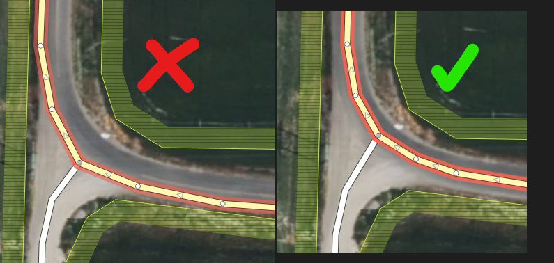
When just starting out, I’m sure most of us have wondered whether we should tick the box stating “I would like someone to review my edits.” Ever wondered who is reviewing those when requested? Turns out, usually, it’s nobody. (See note below)

In my experience, brand new OSM contributors make mistakes frequently. Also, most new mappers don’t stick with it. Both of these points are OK, but we can correct the mistakes to improve data quality, and hopefully let new mappers feel welcome and like they’re part of the community.

The Solution

Fortunately, there is an excellent tool that makes it easy for experienced mappers to find newbie, review-requested, or suspicious changesets - OSMCha. You can also monitor your local area. It’s really fun!

  1. Go to OSMCha.org
  2. Log in with your OSM account.
  3. (Optional) Click on your OSM username dropdown, choose Account Settings. Remove text in “Review Comments Template”. If you don’t, when you verify a changeset as good or bad in OSMCha, it will make an aggressive-sounding comment on your behalf. I prefer to write my own comment on each changeset I review for new mappers.
  4. Click the Filters button and choose filters, see note 1 below.
  5. Click Save in the upper left so you can come back later without having to enter filters again.
  6. Pick a changeset on the left bar, review the changes, and optionally leave a comment. See note 2 below.
  7. In the upper right, verify the changeset as good or bad, and maybe add tags. (You can always change things later.)

Notes

Changeset Filters

For reviewing new mappers’ changesets, here are the filters I use:

  • Location - Draw a border around my local area. (I review all in Utah and some in USA west)
  • Reasons for Flagging - “New Mapper”, “Review Requested” (Set to AND!)
  • Review Status - “Not Reviewed”

Changeset Comments

Here are some things I might include in my comments.

  • Mention that rather than nitpicking, I’m reviewing changes specifically because they requested a review.
  • Recognize one or more things done right
  • Welcome them to OSM if they only have a couple changesets
  • Point out potential issues in a friendly way
  • Acknowledge that sometimes there are multiple ways to map things, or that sometimes people will disagree
  • Thanks for your contribution(s)!
  • Sometimes, I say they can ask me if they have any questions.

Changeset Stats

  • In January 2024, there were 37,000 changesets that were tagged “review requested.”
  • 14,000 of them were by new mappers.
  • Only ~500 of them received at least one comment.

Regarding OSM GPS Traces

Posted by Xvtn on 6 November 2023 in English.

I’ve found it very enjoyable to record and upload GPS traces as I do various activities. These can help with assessing imagery offsets, route accessibility and popularity, adding brand new routes, and as a refresher after I get back from a walk, hike, bike ride, or drive. Here are some questions, issues, etc. I’ve been thinking about. Feel free to comment on any or all:

  1. Am I helping or hurting by uploading GPS traces with poor accuracy? They will average out as they accumulate, but there is no easy mechanism I know of to achieve this for your typical mapper.
  2. Given that the standard OSM GPS (raster) layer doesn’t seem to favor newer traces over older ones, what happens when a road or path is moved, removed, or repurposed? All that old data is now actively harmful. (Again, in the context of the OSM raster traces layer)
  3. What is appropriate to upload? My 100th daily walk along the same route as always? Off-trail wilderness exploration? Airplane flight path? (IMO, the answer to all of these is either “not appropriate” or “if you really want to, as long as it’s well tagged”)
  4. What about people who sort of dox themselves by not turning off their GPS at home, or by owning a driving assistance device that seems to auto-upload all their travel!?

Please let me know your thoughts in a comment, and happy mapping!

Proposed Cache County UT Edits

Posted by Xvtn on 6 June 2022 in English. Last updated on 8 June 2022.

Here are a few edits I’m interested in making in the coming months. I’m hoping to get feedback and discussion here.

Use of Directional Prefix on Streets

The proposal here suggests a system that would change street names such as “East 200 North” to just “200 North” and moving “East” to name:prefix. This system is already in use in Salt Lake City and in my (limited) testing seems to work fine with geocoders. example

Some streets in Logan have already been changed to this format. Personally I think consistency throughout the city is more important than the tradeoffs between each way of doing things.

This change seems relatively simple to update all at once using an automated edit.

Address Import

Address data is available from UGRC, and according to the Wiki it looks like the license will work with OSM. Other than a few exceptions sprinkled here and there, the vast majority of Cache Valley does not have address tags.

Challenges

  • I don’t have experience with making automated edits, but am moderately confident at scripting, so I’m confident I could figure it out especially since there are a few wiki pages describing the process others have used.
  • Because of mostly hand-traced building outlines, there no doubt will be hundreds of conflicts or corner cases that will require manual review and possibly in-person survey. I’m happy to go in person to check an address in the valley, but one guy can only do so much of this. I’m not sure what system (if any) is best to queue up manual review cases and mark them as solved. Notes? fixme=* tags?
  • Building outlines have not been completed in Cache Valley.

I’m open to any criticism or comment on anything discussed here, or on other edits that might need to be made to improve the map!

Edit: Additional info from community

In addition to comments on this post, here are a few other things brought up on OSM US slack:

  • mvexel points out that this was also discussed on the Utah OSM wiki. So, to follow the Utah established conventions, it looks like highway=* name=* under grid systems, the prefix should be dropped. (and presumably go to name:prefix=*). The addr:street=* tag on non-road features should use the full prefixed street name.
  • It looks like the prefix separation has been implemented in other areas using a grid system as well.
Location: The Island, Logan, Cache County, Utah, 84322, United States