dieterdreist's Diary Comments
Diary Comments added by dieterdreist
| Post | When | Comment |
|---|---|---|
| Peaks and Mountains | @osmuser63783 I like wikidata, but it is not a substitute for mapping stuff in OSM. We’re a mapping project with the aim to map the world, mountain ranges shouldn’t be out of scope. |
|
| Peaks and Mountains | Interesting read. I agree from the currently common options a site relation seems best for a natural=mountain object, where it is needed (i.e. peak name and mountain name are different), because it elegantly avoids the problem of having to define a precise area and doesn’t need any additional geometry. Regarding the mountain ranges, we could have hierarchies of nested mountain ranges (at the lowest level, nodes (peaks) or site relations (mountains) could be added, while everything above would only contain relations. Having 5 levels (or more) of nested mountain “areas” (consisting of nodes and relations) wouldn’t be a problem or expensive with the current system - if people can agree which mountains are in which range, and which ranges build up the ‘‘named mountain area’’ in the next level. |
|
| Direction-Tag subtiler Bedeutungsunterschied Geltungsrichtung vs. Blickrichtung, z.B. bei bei z.B. highway=give_way und highway=stop | es ist in der Tat sicherer, mit direction die Richtung anzugeben, anstatt über “forward” und “backward”, weil letzteres im Falle, dass sich 2 ways im selben node treffen – übrigens eher üblich für traffic_sign nodes, weil sich dort ja eine Eigenschaft ändert – oft nicht definiert ist, und es kann sich weiterhin jederzeit die Richtung eines der beiden ways ändern und dadurch würde es zukünftig undefiniert. Eine andere Variante ist, das Schild wirklich dort zu mappen, wo es aufgestellt ist, bzw. eine Idealisierung dessen, also einen node zu machen, der nicht Teil des ways ist, sondern rechts davon liegt. Ich mache das so und habe (entgegen der üblichen Unkenrufe) damit bisher gute Erfahrungen gemacht. Die Schilder mappt man ja sowieso eher, um den anderen Mappern zu kommunizieren, warum etwas gemappt ist, und wo man die Information gesehen hat, aber eigentlich nicht, um für Router o.ä. Auswirkungen zu erzeugen. Auch für detailliertes 3D-Rendering (anderer Anwendungsfall) ist die genaue Lage des Schildes interessant. Bei dieser Methode ergibt sich die Richtung bereits implizit durch die Position des nodes (man könnte sie aber natürlich trotzdem auch noch explizit mappen). |
|
| presets are a sensitive topic | Things have evolved, iD now adds crossing=marked while personally I had already changed habits and switched to crossing=zebra which I use til today. It is concise and clear, duck tagging™ and I never really loved the “uncontrolled” value for what is clearly a controlled situation in my eyes. It has been there most of my mapping time and I had accepted it as osm convention, but with some queasy feeling. It’s a pity that “marked” is apparently gaining so much traction as it feels like a step back and leads to additional tags to specify that it is actually a zebra crossing. |
|
| history is a hot mess | Yes I have also seen some historic=unique_name, naturally this doesn’t work out, so I believe sooner or later they will be tagged with generalized tags, and in the meantime you can consider it historic=yes even not understanding the name. |
|
| history is a hot mess | Unlike you, I am not strongly opposed to tags like roman_villa or roman_road but I agree there is some unneeded redundancy in combination with historic:civilization, and we would ideally not tag like this, thing is these verbose/specific alternatives are used more frequently. |
|
| Der "Sackgassenwohngebietsflyer" | und, wie ist rückblickend der Erfolg? Hat es funktioniert mit den Flyern oder wird man trotzdem angepöbelt? |
|
| Archaeological Discovery | That’s a great find Anne, congratulations! |
|
| Crediting OSM - A Logo Story | I like your joke. I agree that the combination of a logo which expands with a huge and bold OpenStreetMap text, might be a good solution for attribution, but typically (e.g. mapbox, google, here), as very few users are expected to click on the logo to expand it, the logo has also a text (i.e. it should be tried whether the non-expanded logo can have a OpenStreetMap text (probably smaller) also when it is not expanded.) Our logo is not so famous that it can be seen as sufficient attribution alone. |
|
| proposals rejecten | ich habe mich bei dieser Abstimmung (aktiv) enthalten, was mittlerweile nicht mehr wie eine Nein-Stimme zählt, aber 10 Anmerkungen und Fragen die ich hatte und die im Proposal nicht klar waren zeigen m.E. auf, dass es da durchaus Gründe fürs Ablehnen des derzeitigen Stands gegeben hat. Man kann die Tags natürlich trotzdem nutzen. Abstimmungen sind nicht das letzte Wort, hier aber schon ein Hinweis, dass man die Definitionen verbessern sollte.—~~~~ |
|
| Is an underground train station a building? | I am pretty sure, an underground station is kind of a building. It is made for people to got into it and use it. For OSM tagging, we use “building” for both, actual buildings and structures where you can go “inside”. |
|
| Sustainable Travel Expenses Resolution – Request for Support | I support this proposal |
|
| My August 2020 in OSM | based on your local experience (not people working professionally in the field, i.e. not counting attendance of employees to international conferences), what is your guesstimate for female mappers (compared to the rest, i.e. mappers that don’t identify themselves with the term female) in your area? From what I see locally, on various mailing lists and fora, more than 5% does not seem likely. |
|
| My August 2020 in OSM | Actually I did not claim we do not have the problem of having too few female mappers in OpenStreetMap (because we actually do have too few), what I wrote was that IMHO the problem is not having too few women in the OpenStreetMap-Foundation board, because actually women are over represented on the board compared to the number of female mappers. |
|
| Why I am mapping trees | your adhoc tag natural=fallen_tree seems perfectly valid, suitable and intuitive for this situation. What are your doubts? I’d go an document it, there are already 9 of them ;-) https://taginfo.openstreetmap.org/search?q=natural%3Dfallen_tree |
|
| Why I am mapping trees | Great post. Maybe the natural=tree_stump is also of interest for your tree mapping, thinking about trees cut down for safety reasons, it can create the gap. |
|
| Announcing an Update to Daylight Map Distribution | Can you please explain in more detail which kind of edits you remove? Is it about names, geometry or additional tags? Are political boundaries for every recognized country contained? Are there countries where the contained boundaries have to be swapped with a different set for legal reasons, and if yes, are these alternative boundaries also contained? |
|
| Parkplatzanalyse mit OSM-Daten am Berliner Praxisbeispiel „Pop-up-Radweg“ | interessante Analyse, Kompliment! |
|
| What does the path say? | another “whoosh” in Italian: |
|
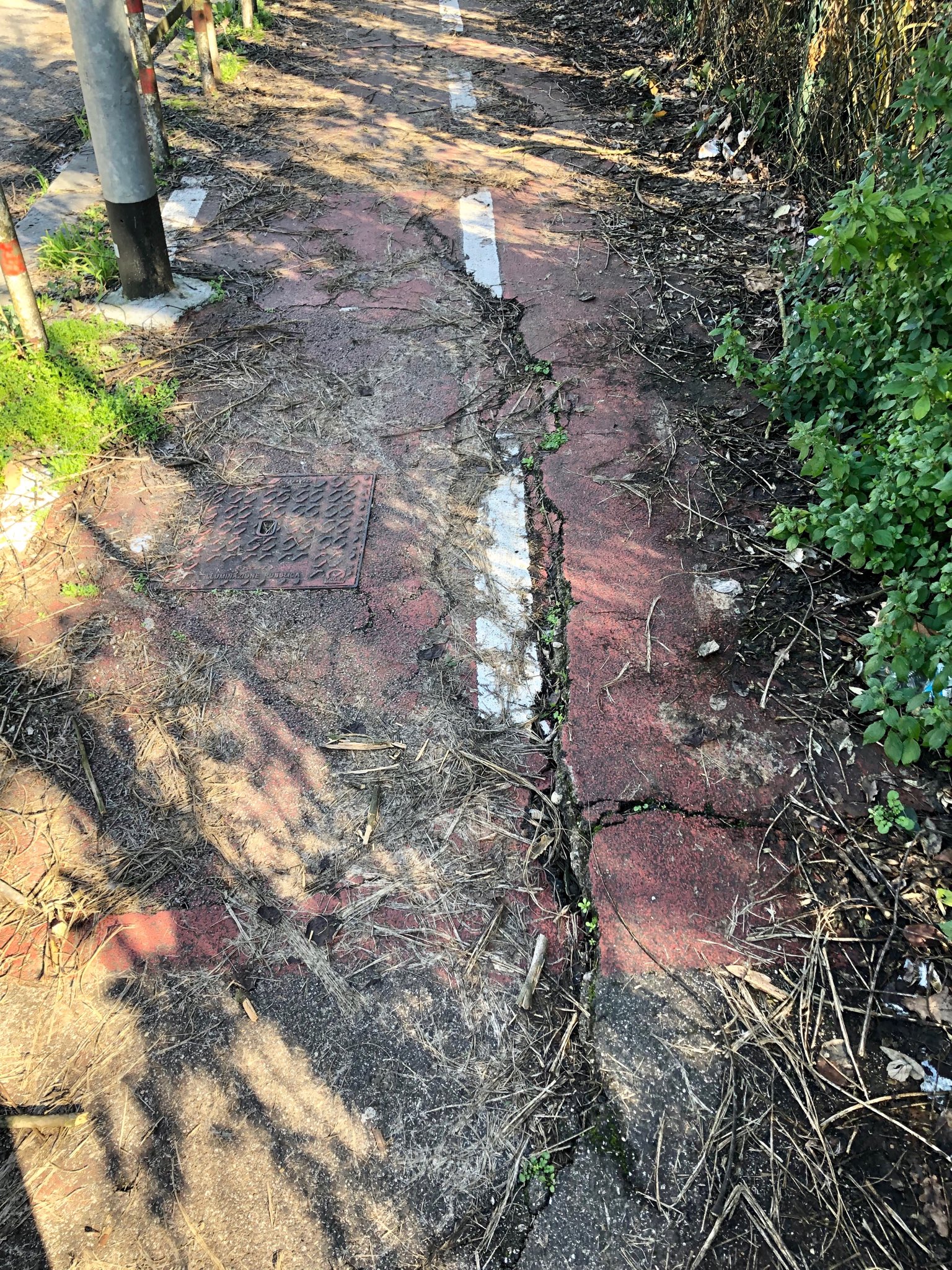
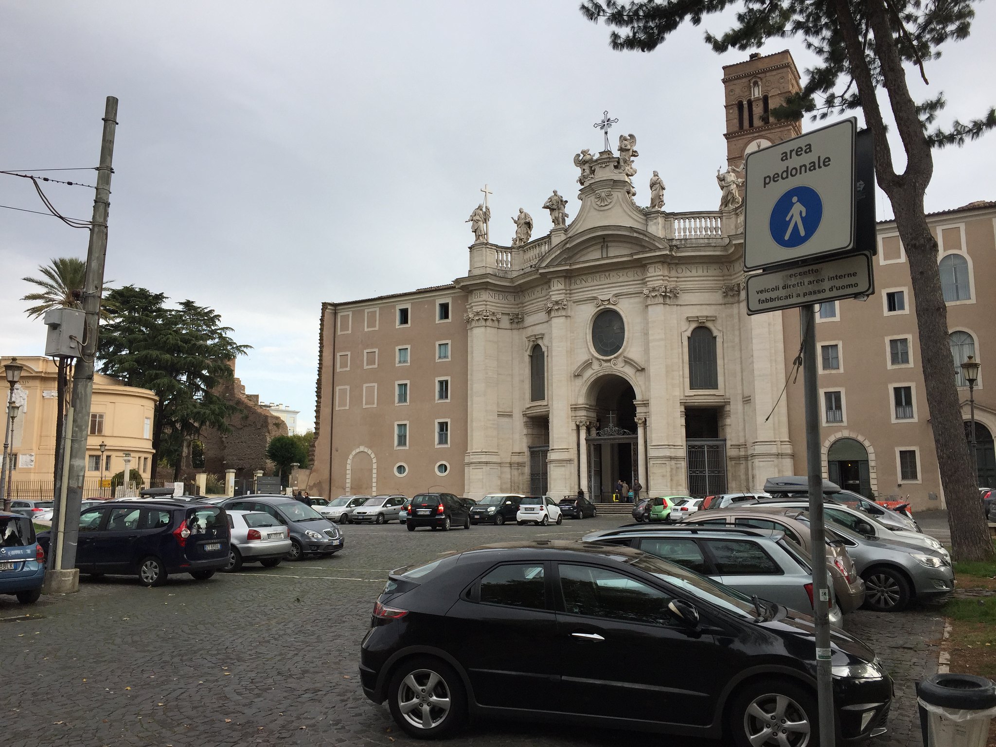
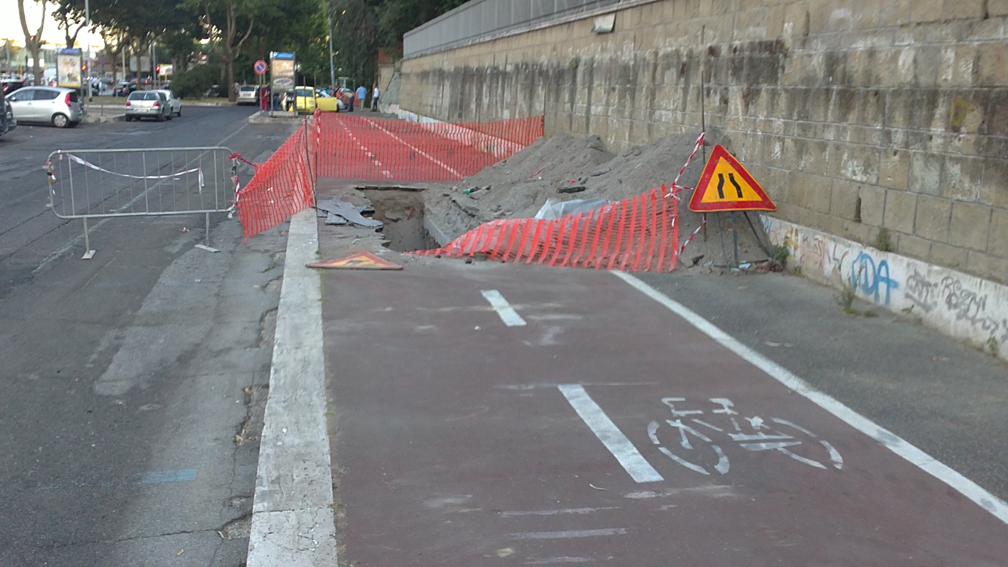
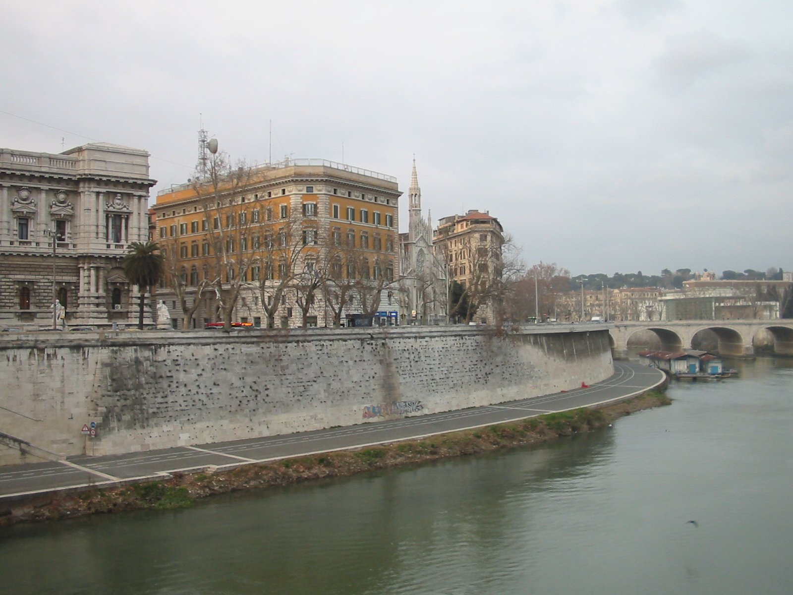
| What does the path say? | This is the typical situation where one extrapolates from the local situation to presumed worldwide implications. IMHO we should always add surface tags to highways, as it removes uncertainty. Here 3 examples from my local area that illustrate how the legal, signposted reality does not meet with central European expectations: combined footway and cycleway
pedestrian area - with some “exceptions”
cycleway with some obstacles - whooosh
cobblestone cycleway along the river, maxspeed 10km/h - taptaptaptaptaptaptaptap
|