OpenStreetMap

balrog-kun's Diary

Recent diary entries

Showing OSM to travellers

Posted by balrog-kun on 21 August 2012 in English.

This weekend was OSM workshops again, this time we were at a sort of a travellers get-together / summit / festival thing in Boruszyn, Poland. This is a tiny village where Kazimierz Nowak set out for his 40000km bicycle trip across Africa in 1931. The village was mostly unmapped before the festival and there was no usable imagery better than Landsat, so we got to use the pool of GPSes that the OSM Poland association received from Mio Technology Ltd. They are some of the cheapest loggers available, Holux M-1000C, but they worked almost fine for us. The main downside for me was lack of Linux support for downloading the tracks or setting receiver configuration. The BT747 project as well as gpsbabel and mtkbabel all claim to support the M-1000C model but apparently the download protocol is different across different revisions of this model, other people’s comments on the web reflect this too. We had to use a Windows laptop with the ezTour program that ships with the receiver but is tricky to get working too. It also has the annoying default setting of logging GPS points every 5s instead of every second, which gets written to the device whenever it’s connected to the laptop.

We had some bikes and managed to add a lot of detail in nearby villages in OSM. Some teens of the local scouts team that was helping in the festival organisation also joined the workshop and I could pick their brains about more things in the area to add to the map.

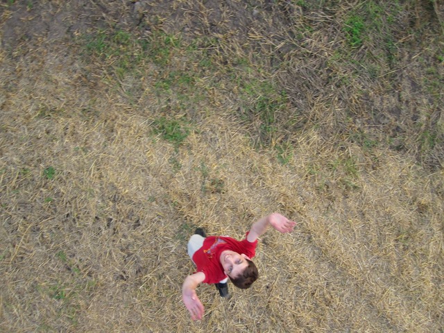
We managed to snap some kite imagery on the last day. Technically we only made some slight errors but the timing was unfortunate because a bunch of attendees had already left before then, and the previous two days saw no wind.

Personally I was amazed by the travel stories of some of the attendees. Many of the people there had been to Mt. Everest, some had biked across Siberia or South America or canoed across the Pacific, and one person ran around the globe (yes) over almost a year running a distance of over 2 marathons every day.

Boruszyn village from upside

Location: Garncarski Bród, gmina Połajewo, Czarnków-Trzcianka County, Greater Poland Voivodeship, 64-712, Poland

OSM tent at Woodstock was a blast

Posted by balrog-kun on 13 August 2012 in English.

One week ago OSM was one of the projects present at the “Freedom Tent” at the Woodstock Festival. The festival was attended by about half a million people, and we had an incredible number of interesting people come over to talk about free software or free technologies, and take part in the workshops. Some got very excited about OpenStreetMap, in fact we had two fresh new mappers who after the first day’s workshop came on the next days to help us organise the same workshop again.

We only had four computers for the workshop use and we used one machine as a sort of terminal with a monitor and a keyboard facing out of the tent. It ran a small web application I made which shows the kite imagery of the festival that we made a year ago, georectified, as an OpenLayers slippymap. You could click the map and draw the outline of your tent if you remembered where you stayed, then describe it and leave your e-mail address if you liked. We had about 70 festival goers mark their tents on it in the last two days, the app can be seen at http://osm.trail.pl/woodstock.xhtml.

The workshops were a little chaotic but successful, almost everyone registered on OSM right away and added a couple of features. I was surprised to see at least half the participants actually read the full contributor terms before registering. Then there were also two who didn’t remember their e-mail passwords so we ended up using my gmail address. We also handed out lots of business card sized OSM leaflets, and we’ve got three new members in the OSM Poland association

Then on the day after the festival ended I was packing up my things among lots of people with heavy back packs leaving the camp and I saw two girls carrying, in addition to their backpacks, and a big 50cm globe with a political map from the 80s. They explained that the globe was their long time travel companion that they use to show people where they’re going when hitch hiking. I wish I had snapped a picture of it.

Orthorectified kite imagery

Location: Warniki, Kostrzyn upon Oder, Gorzów County, Lubusz Voivodeship, 66-470, Poland

Join us at Woodstock 2012

Posted by balrog-kun on 30 July 2012 in English.

If you’re coming to the Przystanek Woodstock festival this week near the Polish / German border, you can join us at the “Freedom tent” briefly mentioned here and you can set up your own tent at the OpenStreetMap Village.

The Freedom tent is a stand in the NGOs alley we’ve been preparing together with the Free/Opensource Software Foundation, Wikimedia local chapter, The Warsaw Hackerspace and The FreeLab sustainable living project.

No mapping party this year as the area has been mapped in detail last year, but we’ll have workshops and we’ll be snapping Kite Aerial Pics like we did last year

Orthorectified kite imagery

Location: Warniki, Kostrzyn upon Oder, Gorzów County, Lubusz Voivodeship, 66-470, Poland

Last year I posted something on what’s happening around the OSM Poland association and haven’t posted any updates in English since then. Now SOSM (sosm.ch) has been registered by Swiss mappers (congrats!) with a similar purpose of functioning as a local chapter and it reminded me to give people an update on what’s happening with OSM Poland. We had our second AGM the last weekend of March and got around to summarise what we had been up to in the first year of the association’s work. I think we were all surprised at how many things the association had been involved with even though not much of that had been visible from outside. Activities involved 6 or so mapping parties organised around the country, presenting the OSM project at conferences of all kinds, workshops, acting as the contact point for a couple of local companies (at least three publishing companies, some taxi operators and a fleet monitoring company), setting up a locally hosted tileserver in one of Europe’s top data centers in Poznań (very futuristic inside!) with one new stylesheet and one borrowed form hikebikemap.de. We also responded to some government requests for comments on new proposed acts of law that we thought were relevant to the openness of geodata. At the time of the AGM we had over 40 individual members, one “honorary” member and one other NGO as a supporting member: the “Wspinka” mountain climbers association. Financially we barely had enough money to print some leaflets, but this hasn’t been an issue so far.

Since March there’s even more going on, we’re closing in on 50 members with one transportation company as a new supporting member. We have a new board and new auditors. In May we presented OSM at universities, schools, science fairs and various types of events. Some of those had been very successful (particularly those where we could talk specifically to geodesy or geography students, many of whom have interesting projects and ideas of their own) and some less so (e.g. one where the room allocation at a university failed and I got to explain OSM to those who arrived, in a corridor). In August we’ll have a stand at the Woodstock Music Festival in Poland together with the Wikimedia local chapter and one more free knowledge related organisation. There are some great ideas already on what activities to have at the stand, possibly we’ll also see members of the German Wikimedia chapter there as the festival is right at the country border. Last year Woodstock attracted 1.5 million folks and we had a mapping party right there, taking kite photography of the area, mapping and talking to people about OSM.

Since March we’ve also started seeing local governments, at what would be county or municipality level in an English speaking country, take interest in OSM and contact us.

Now perhaps the most interesting part is the 1st monthly POI contest that just finished today, organised with efforts from many OSM Poland association members. The idea is really simple: points are awarded for different types of POIs added in Poland and the mapper with the top score gets a prize (or two). The prizes include OSM tshirts, jerseys and gadgets from the Mio satnav manufacturer who will be launching two OSM based devices in fall this year and wants to help add more coverage of tourism-related features in OSM (we actually had a live teleconference with Mio at the March AGM - Mio also agreed to participate in travel costs for speakers for OSM talks/workshops in Poland).

The June edition of the contest could be tracked live through an (IMHO) very clear web interface at http://osmapa.pl/konkursy/poi/1/ (including total stats and hourly break-ups) and I believe you can now start picking up points for the second edition ending July 31st. The UI is in Polish but you’re welcome to participate from anywhere as long as you’ve collected some data in Poland first hand :) I ended up at a lousy 42nd place, but the top mappers scored POI counts of over a thousand. Additional fractional points are added for specific attribute tags. The board ended up awarding the top 3 mappers this month because they had put so much effort in this. All in all I’m positively surprised with the results. With the help from Mio Technology a cycling/hiking trail mapping contest is planned in the future.

I believe the whole idea came from a small campaign two months ago to add as many fire hydrants as possible, which caught some popularity through Facebook and apparently thanks to a nice website where you could track the counts of hydrants added. Why hydrant mapping became so popular I have no idea, although it is linked to some media affair earlier this year where (IIRC) the fire fighters stumbled on some non-functional and outright fake hydrants in an emergency. At the end of the campaign Poland had about half of all the fire hydrants in OSM (yay, I guess). I’m looking forward to the results of the upcoming contests and hope I’ll have some time to ramp up my score this month.

Best wishes

Posted by balrog-kun on 25 December 2011 in English.

to You (hereinafter "Wishee(s)")
as copied from various well-known blogs (hereinafter "Blogs")

1. Please accept without obligation, express or implied, these best wishes for a fruitful in the creation of online maps ("Maps"), environmentally safe, socially responsible, low stress, non-addictive, and gender-neutral celebration of the winter solstice holiday as practiced within the traditions of the religious persuasion of your choice but with respect for the religious or secular persuasions and/or traditions of others, or for their choice not to practice religious or secular traditions at all, and further for a fiscally successful, personally fulfilling, and medically uncomplicated onset of the generally accepted calendar year including, but not limited to, the Christian calendar, but not without due respect for the calendars of choice of other cultures.

2. The preceding wishes expressed in Part 1 are granted, without regard to the race, creed, age, physical ability, religious faith or lack thereof, choice of geodata editor application ("Editor") or lack thereof, licensing preference or sexual preference of the wishee(s), on the following terms:

a) they are to be considered extended to all members of your family or other social unit, including but not limited to:
i) other persons directly or indirectly related to you by blood or otherwise and any such persons to whom you consider yourself to be related regardless of biological, legal, religious or other process,
ii) any person or persons not included in paragraph 2a)i) hereof with whom you enjoy regular (or otherwise) consensual sexual activities regardless of gender, race, age or sexual orientation with or without the possibility for procreation,
iii) other animal and/or vegetable organisms (or inanimate objects) you or anyone else may consider part of your family or other social unit;

b) they are freely transferable with no alteration to the original wishes to any person in your wider social circle not included in paragraph 2a hereof;

c) they are limited to a period of one terrestrial solar year or until the issue of subsequent holiday wishes, whichever occurs first;

d) they are subject to clarification or withdrawal and are revocable at my sole discretion at any time, for any reason or for no reason at all;

e) no obligation to implement any of the wishes or responsibility for the consequences which may arise from the implementation or non-implementation of same is or may be implied.

3. These Wishes are void where prohibited by law.

Don't break the HOT chains

Posted by balrog-kun on 22 October 2011 in English.

I think this is curious enough to be posted somewhere.

We're running an OpenStreetMap tileserver at osm.trail.pl with a very nice mapnik style designed by my friend. We have been rendering only a single country area until recently and decided to expand to the full planet. After a couple of weeks of occasionally wrestling with the amount of data in postgres after the planet import, we now have it running the first update from hourly diffs. It has about three weeks worth of diffs to catch up with but it's on the right track. It's still going to take three or four days.

In the meantime I decided to create a new database and reimport the geofabrik country extract that we had been using before, because people started complaining about lack of updates. The import only takes some 20 minutes. Now this database has only some 8 hours of diffs to catch up with OSM, but osm2pgsql was crawling when I launched it, and it looked like this tiny update was going to take about a week. I tried to find the query which was taking so long by SELECTing from pg_stat_activity. The culpable query seems to have been UPDATE planet_osm_ways .. WHERE nodes && ARRAY[$1] ..; I ran the query with \timing on and it showed about 10s to execute on the country extract. I ran the same query on the planet database and it took 0.4s. EXPLAIN showed that on the country extract database it was using a sequential scan instead of using the planet_osm_ways_nodes index. I learnt about disabling sequential scans with SET enable_seqscan = 0; but it kept using sequential scan anyway. When strange things happen with postgresql there's usually one person in #postgresql who can explain it, his nick is RhodiumToads. And he did explain, and the explanation is this:

Certain postgresql indexes will not become ready to be used if there exist transactions opened before the table in question has been created (these would be the 4 transactions opened by osm2pgsql planet update) and there are HOT chains and, during the period after the table has been created and before the index has been created, an event occurs which break those HOT chains. The event is usually a HOT-update on the table.

To avoid breaking the long running planet update, the workaround I had to use was to modify osm2pgsql to create the planet_osm_ways_nodes index immediately after all of the data is COPY'ed into the table and before any UPDATEs run when "going over pending ways". Then we reimported the country extract using the modified osm2pgsql and voila, it ran normally again.

Zapraszamy na warsztaty OpenStreetMap w ten weekend w Warszawie! Będzie to głównie wprowadzenie do mapowania od podstaw ale również weterani OSM nam się przydadzą więc zapraszamy wszystkich. Mamy już zapisaną pewną grupę uczestników ale przyjdźcie nawet jeśli zdecydujecie się dopiero dziś (możecie puścić mi informacje aby pomóc w organizacji). Jutro jest dniem terenowym i spotykamy się o 11 rano przed wejściem do Sadyba Best Mall, a niedziela wstępnie przeznaczona jest na wprowadzanie danych i teorię.

Możliwe, że będziemy też wykonywać fotografie z powietrza jutro po południu, więc szykują się ciekawe zajęcia.

Location: Osiedle Sadyba, Sadyba, Mokotów, Warszawa, województwo mazowieckie, Polska

OSM workshops, tomorrow in Warsaw

Posted by balrog-kun on 23 September 2011 in English.

Just a quick note that we're organising a two day OSM workshop to introduce people to mapping, this weekend in Warsaw, Poland. So if you're close, feel free to come whether you're a newbie or an experienced mapper. Tomorrow is the surveying day and Sunday is theory and uploading data. If you decide just now, feel free to come over, we'll be starting out of the Sadyba Best Mall entrance 11am tomorrow. You can drop me a note to help accounting.

Additionally we are likely to try kite photography tomorrow and balloon mapping on Sunday if the weather forecasts don't change. On Sunday food is provided too :)

Location: Osiedle Sadyba, Sadyba, Mokotów, Warsaw, Masovian Voivodeship, Poland

I decided to learn about the current state of the OpenAerialMap revival, read the docs and managed to register the bit of imagery we made during the Koluszki OSM Mapping Party in Poland last week. It's not really difficult although you need a little digging to get around the current API. Most information you need to submit your imagery is found at http://docs.oam.osgeo.org/storage/creating.html (Note there's currently some inconsistency in the docs in the way the term Archived Imagery is used)

Slippymap using leaflet-js: http://openstreetmap.pl/balrog/koluszki-kap/
OpenAerialMap imagery URL: http://oam.osgeo.org/image/118400/
JOSM imagery URL: tms:http://wms.openstreetmap.pl/balrog/koluszki-kap/

Note the rectification is of very bad quality, I didn't have much time to do it all correctly, and since there's no other usable imagery of Koluszki available to us, I have only used the GPS traces collected at the mapping party as the georeference. I guess it's better than nothing although it's of much lower standards than most imagery in OpenAerialMap, but it can be a good stress test too, with the high resolution in some spots. I have much more rectified kite imagery from 2011 and 2010, but it's on my crashed harddisk which is at a data recovery place right now.

Oh, right! We had a third true Mapping Party in Poland! It was more fun than expected and also a success map-wise. I think all of us are just waiting for the next mapping party. We have done a fair bit of running around / riding bikes or driving cars, with GPSes and noting things down. We had a printer brought along by User:Zbigniew_Czernik and printed OSM slogans on t-shirts. We tasted some small-town fun because the annual Koluszki Days festivities were in the same dates. We had guests! The chairman of the Wikimedia Poland local chapter was there to talk about possible cooperation with OSM Poland, and to do some mapping himself. And one high-ranked person from the Polish scouts (!) organisation came along to talk a little more about cooperation after I met with them in Warsaw before. We're going to join them at some of their summer camps to teach the younger scouts about OSM and about GPSes and even about aerial surveying with kites.


And we spent a lot of time on the second day trying to get my camera in the air under the kite, but the wind was a little weak. We even had a small emergency situation to add some adrenaline but someone took pictures of us panicking and it was too hilarious when we looked at them later. We tried again on the third day with the wind strength just right and got it up to about 500m or about 1,500ft.

Location: Wypalenisko, Koluszki, gmina Koluszki, County Lodzki, Łódzkie Voivodship, 95-042, Poland

The Haircut Change Process

Posted by balrog-kun on 14 June 2011 in English.

I don't really want to contribute to the license debates, but this is a funny analogy someone came up with on IRC, slightly coloured. :)

Imagine a village with a big, active group of people caring for a pet together, let's say it's a dog, one of those purebred dogs you see in dog show competitions, who is the village's mascot and who gets its hair cut every now and then. There's a community of villagers who maintain a fund for food and other services for the doggie and they all enjoy it and they enjoy seeing their pet grow bigger and win competitions.

Now the doggie has grown up a lot and the project has come a long way since the dog was a puppy and some people started calling for a change of the dog's haircut. They think the old look is inappropriate for a dog of this size and that it looked a little silly from the start. Some people have the opposite opinion though, but both groups are a minority, most villagers don't really care. However, it happens that the owners of the kennel are pro-new-haircut. A lot of people support them because they have taken good care of the dog's place and they became an authority in the village. A process was outlined whereby once there is enough support for the new haircut, the dog hairdresser will visit the village and give the dog a new look. The process has been taking quite long however and there isn't enough support for the change yet. Many people have accepted the change because they like the new planned haircut better, but even more accepted because they support the kennel owners and some did because the process was dragging on for so long, or because they didn't want to upset others.

Now the pro-change people, including the kennel owners committee said they can't look at the old haircut anymore. Phase 5 of the Haircut Change Process is approaching at which point the committee declared it's either the dog with the new haircut or there's no dog. They decided they're going to shoot or poison the doggie if there isn't enough support and people don't grant them an irrevocable, perpetual, world-wide right to decide on the dog's haircuts in the future, and then they said "Now we wouldn't want to see our pet suffer, would we?". They also said the people can keep their old photographs of the doggie with the old haircut even after phase 5.

A new wave of villagers accepted the change in terror, but there's still the group who won't accept. Some of them like the old haircut better but more than that they don't like the way this is handled. Even those that learnt to like the new planned look can't accept the conditions put before them in a way of an ultimatum. A lot of them think this sort of demand from the kennel owners is unacceptable because the mascot's well being is being used to influence the decision.

Unfortunately there's also a big new wave of outrage towards the people who didn't submit to the ultimatum (sign this or the puppy gets it) and blame for the pet's suffering is put on them rather than on the folks who threaten to hurt to animal.

No one knows how the story will unfold :)

Location: Southland, New Zealand

Just a short note that a friend of mine in Ecuador told other teachers at her university about OSM and now they have used it to make the map of Salinas (see the map link) and will use it for some sort of exposition of their map project at the Salinas campus of Universidad Tecnológica Equinoccial (UTE). I don't know anything about the project but you can probably visit if you're in the Salinas area.

Location: Sindicato de Sales, Salinas, Santa Elena Province, 241550, Ecuador

Just thought I'd dump them here..

* Last weekend, March 5, in Łódź, Poland we celebrated the first meeting of Polish openstreetmappers bigger than 5 people (yes, we're a little bheind but we're getting there) and at the same time we have formally incorporated the local OpenStreetMap Association which may become a OSMF local chapter at some point in the future but in the first place will help us in contacting local institutions, funding local projects, being a point of contact for local companies etc. The association will become fully legally registered in a month or two. We talked to the press, held a wanna-be mapping party and had a couple of interesting presentations including one by a commercial osm-based navigation vendor. User:tomianek has been selected as the board chairman among other reasons due to his good relations with some local institutions. I was elected the treasurer. Personally I'm a little disappointed with all the stress on promotion, formal contacts and funding, and lack of stress on actual mapping projects.

* Schuyler Erle announced on the OpenAerialMap oam-talk mailing list that he and Chris Schmidt joined MapQuest with the specific goal of working on rebooting OAM and that initial results can be expected as soon as in a couple of weeks. Yay!

* Also, Jeffrey Warren started a series of interviews with grassrootsmappers at the Grassrootsmapping.org/PublicLaboratory blogs, see http://publiclaboratory.org/report/mapper-interview-dawn-mckinney

* Also, Spanish mappers imported Corine Land Cover forests polygons and Slovakia mappers are in the process of importing CLC / Urban Atlas data.

My FCOIII is looking sad.

Posted by balrog-kun on 7 January 2011 in English.

This is my FPV camera after a 200m dive from the kite when the rig failed yesterday.

It fell on the roof of a Ferrari car-service (seen below from a photo camera which made it safely to the ground) and it kept recording/transmitting for another 30 minutes despite the twisted head joint and being covered in snow.

In other news last week groupon.com had an offer for sight-seeing flights over Warsaw, Poland, in a two-seater ultra-light airplane for just about EUR20. I bought three coupons :) They let you decide the route and altitude and buy additional kilometres for 50cent/km and I hope that will let me complete most of the free (as in freedom) aerial map for my city, till now made with the kite or rc helicopter.

Location: Grochów-Południowy, Praga-Południe, Warsaw, Masovian Voivodeship, Poland

The Cardboard Box Makers Club

Posted by balrog-kun on 6 September 2010 in English.

See The Pottery Club for context

Imagine a small town with a very active club of cardboard box makers. The club members make and supply cardboard boxes for the town's people and the people are mostly happy with that. There are some other box suppliers, but their boxes are not recyclable and are actually closed, so you can't put your Garmin GPS in one of those boxes. You need an open box to do that and the Cardboard Box Club makes such boxes.

This club forms a small community of box makers, most of them are crafts people who make the boxes as a hobby. Each of these boxes is a little different, some boxes have round corners or strange sizes or aren't exactly cubic, because they are hand-made. Now the people in the town can cope with imperfect boxes but they would prefer standard sized boxes with no variations, so they can efficiently store things in them. In fact most of the community are people who had a need for good cardboard boxes, but couldn't find ones that would satisfy their needs anywhere, so they decided to do something about it and joined the club.

Now not all boxes in the world are hand-made. There are industrial machines (more automated or less automated) that can make perfect boxes in large quantities and some people in the club know about them. Many of the club members were disillusioned when they first learnt about the useful machines that made the boxes of the same size as they had been making personally, and had been regretting the time they put into doing it manually when they could be perfecting the craft of operating such a machine. They know that the users of their boxes would have been happier too.

Of course not all of the machines are perfect, some (like the model called PANTHER) are more sloppy than human box makers, but still very fast.

However there is a couple of members in the club who make every effort to discourage the usage of the box-making machines and instead prefer doing it manually and that everyone else also does it manually. One of their arguments is that operating the machines isn't as engaging as doing it manually and the club's community would fall apart. There is however a community of box making machine operators that is good friends with the club, sometimes even the makers of these machines come to the club meetings to socialise.

Despite this anti-automatic-box-making minority, some people are already using machines to make their boxes, and the users of the boxes seem happy. Some of the clubbers even made robots that wander around the club room and fix some of the imperfections of the boxes made by the beginner box makers.

There is however one of the anti-automatic-box-making clubbers who went as far as saying that all of the Australian machine-made cardboard boxes should be burnt or recycled, even taking them away from people who have already stored some of their Garmin GPSes in those boxes, and subsequently re-made manually. He is generally of the opinion that manual box making should be the only way to make boxes in the club, and if the cardboard's period of bio-degradation is shorter, then all the better because the club will have more boxes to make. He also encourages some of the members to leave the club and start their own so that the clubs can compete against one another, and the losing club's boxes all go to waste.

Needless to say this is very far from what the town's people would like (and most members). They just want good boxes and don't want anyone's efforts wasted on things other than perfecting the boxes.

More on MediaLab Chrzelice mapping

Posted by balrog-kun on 23 August 2010 in English.

I posted some information about the MediaLab Chrzelice (Culture 2.0 Camp) here but now that I think of it, it was also a sort of a Mapping Party, even if very chaotic because I'm a poor organizer and because of the rush. (also most likely the first osm mapping party in Poland)

So here are some thoughts about it as a mapping party and some of my impressions, in case they're useful to anyone else making a similar event.


  • Downside: there wasn't much time because in the "Digitisation" workshop the map was just going to be used as a tool.
  • Downside: the GPS loggers that we ordered had not arrived on time. Instead we used three GPS-equipped phones (one was android based, OSMTracker installation went without problems and the program worked really well, two other ones were nokia Symbian(?)-based and the NokiaSportsTracker application also worked well although things like saving tracks were not immediately obvious)
  • All of the workshop participants (about 14?) were new to OSM except one.
  • Most people had historical / ethnology / sociology / .. research background.
  • I had just about 30 minutes to introduce everyone to OSM on the first day, tried to take the workshop's theme and the village's history into account. Explained how there wasn't any really free source of geo data in that region and that the governments probably will release the data in a couple of years (which would make our efforts pointless) but that OSM will probably have a role in speeding up that point, and about things we can add that governments don't have like all the wheelchair navigation aid data.
  • Didn't have any slides but showed some wiki pages and, importantly, two videos: first the sward's Bradford mapping party animation of Sep 27 2008, and second the ito's A Year of Edits 2008.
  • Upside: Some participants got really enthusiastic about mapping, about eight people chose to join the mapping part of the workshop (the other eight recorded interviews with some elderly villagers, scanned documents etc). I heard at least three or four people in the mapping part of the workshop urging to "go mapping already" and also asking about the software to input data (JOSM).
  • I'm not sure but I think that the A Year of Edits video made a great impression on people.
  • We also went out to fly a kite and a balloon (on the first day, with no wind) and make aerial imagery. Seems to have been a great bonding factor even though we didn't manage any decent imagery. Specially on the second day when wind was rather strong and it really required a group effort to hold the kite line.
  • By the time we sat down to put the collected data into OSM (about 5 people only who had data and had their laptops) everyone had JOSM already installed on their own, out of curiosity.
  • Since the village was too small to do a cake diagram, we didn't divide the area and so we had lots of overlap and lots of conflicts when editing. It's worth to learn to resolve conflicts quickly if you're going to make a workshop like that, even though they almost never happen in practice, when mapping alone. Also was a good idea to make it a habit to announce it whenever somebody in the room uploads a changeset so that everyone updates their local copy immediately.


Two more pics at http://blog.openstreetmap.pl/2010/warsztat-chrzelice/

Location: Stawiska, Chrzelice, gmina Biała, Prudnik County, Opole Voivodeship, 48-220, Poland

Culture 2.0 Camp mapping summary

Posted by balrog-kun on 17 August 2010 in English. Last updated on 1 October 2010.

The Culture 2.0 Camp in Chrzelice, Poland finished yesterday. It was a MediaLab-style experiment in form of a four-day camp filled with workshops. Chrzelice is a (now) tiny village with a rich 700 years-long history. One of the workshops was concentrated on digitising this history and preserving the local cultural heritage. One of our aims was to digitise and archive some fragments of that heritage but in the first place it was to come up with good and sustainable tools and methods of doing that. People with a range of different backgrounds took part in that workshop: historians, sociologists, ethnologists, librarians, programmers and many more. As a result the range of tools that we used was also varied:
* recording social interviews with members of local community, some of whom remember the good days of Chrzelice castle in early 20th century (today ruined)
* scanning and photographing old documents and objects of historical significance, with engagement of a few employees of the Silesian Digital Library and the Warmian-Masurian Digital Library
* 3D scanning,
* building a map of the area in OSM.

In addition to the basic map features we put some stress on the monuments of the past and important historical objects, as well as local (even colloquial) place names that are in common use by the ~600 inhabitants, but which never appeared on an official map. It's worth noting that most of the other online map services lack 90% of the village streets in this region.

We used GPS receivers that participants had in their phones (the four GPS loggers that we had ordered specifically for that workshop had not arrived until a couple of days later), we used walkingpapers.org, we used some 2007 aerial imagery owned by a local historian-amateur Eryk Murlowski, and we tried Balloon Aerial Photography and Kite Aerial Photography to produce our own imagery. Unfortunately we had problems launching the hot-air balloon high enough, because of poor construction (in my tests before the camp we had it fly much higher) and the wind conditions were not ideal. We had more success with the kite, we managed getting it up to about 500m high on one occassion, unfortunately the camera wasn't set up properly on that flight resulting in motion-blurred pics. Something to improve before the next workshop, although I think the idea was good and the learning experience for the participants was valuable.

Location: Stawiska, Chrzelice, gmina Biała, Prudnik County, Opole Voivodeship, 48-220, Poland

I posted some pictures from our first step in BAP at http://unadventure.wordpress.com/2010/08/08/bap-test-flight-1/

I hope to perfect the tools and techniques enough until Wednesday so I can produce some simple, but usable ortho imagery of Chrzelice, Poland during the Culture 2.0 Camp this week, specifically to aid the mapping that will potentially be done during the digitalisation workshop.

Location: Augustówka, Mokotów, Warsaw, Masovian Voivodeship, Poland

Szczecin buildings import summary

Posted by balrog-kun on 20 June 2010 in English.

So I posted a little summary in English of the buildings and trees tracing and importing in Szczecin on my blog: http://unadventure.wordpress.com/2010/06/20/mostly-done-with-szczecin/

Posted it there because it's more from a personal point of view than a technical summary. You can find another summary, in Polish, but including some nice screenshots at the OSM blog at blog.openstreetmap.pl/2010/szczecin-najbardziej-kompletnym-miastem/

Now I need to catch up with all the things I noted down while surveying in my own city, and had no time to input into JOSM till now.

Location: Międzyodrze-Wyspa Pucka, Śródmieście, Szczecin, West Pomeranian Voivodeship, Poland

As documented at http://wiki.openstreetmap.org/wiki/WikiProject_Poland/Warszawa#Linie_kolejowe_i_tramwaje (Polish) I have now assigned the tags tactile_paving=yes/no and (if yes), tactile_paving:slab_size=35x35 or 40x40 (cm square) according to the data from the Warsaw tram operator that arrived in my mailbox in December, which I requested in August -- nevertheless kudos to them. The names of nearly 500 tram stops equipped with tactile paving was printed on 16 pages of paper (yes, those rectangular white sheets).

Next thing, now that I know we have all or nearly all stops in the city, is to script creation of tram route relations and keeping them up to date using the schedule data availabel through the operator's web api. Hopefully the script will be reusable for other cities and for bus / train routes too.

My current idea is to store (outside of OSM database) the fragments of routes between each two adjacent stops and combine them to form a full tram / bus line route when updating. Where there's no connection between two stops stored yet, just use shortest path in a graph to find a route, later when a human editor fixes the relation, the new route fragments will be stored on next update.

Location: Solec, Śródmieście, Warsaw, Masovian Voivodeship, Poland